
MyTopo
Hilgard Mountain Utah US Topo Map
Couldn't load pickup availability
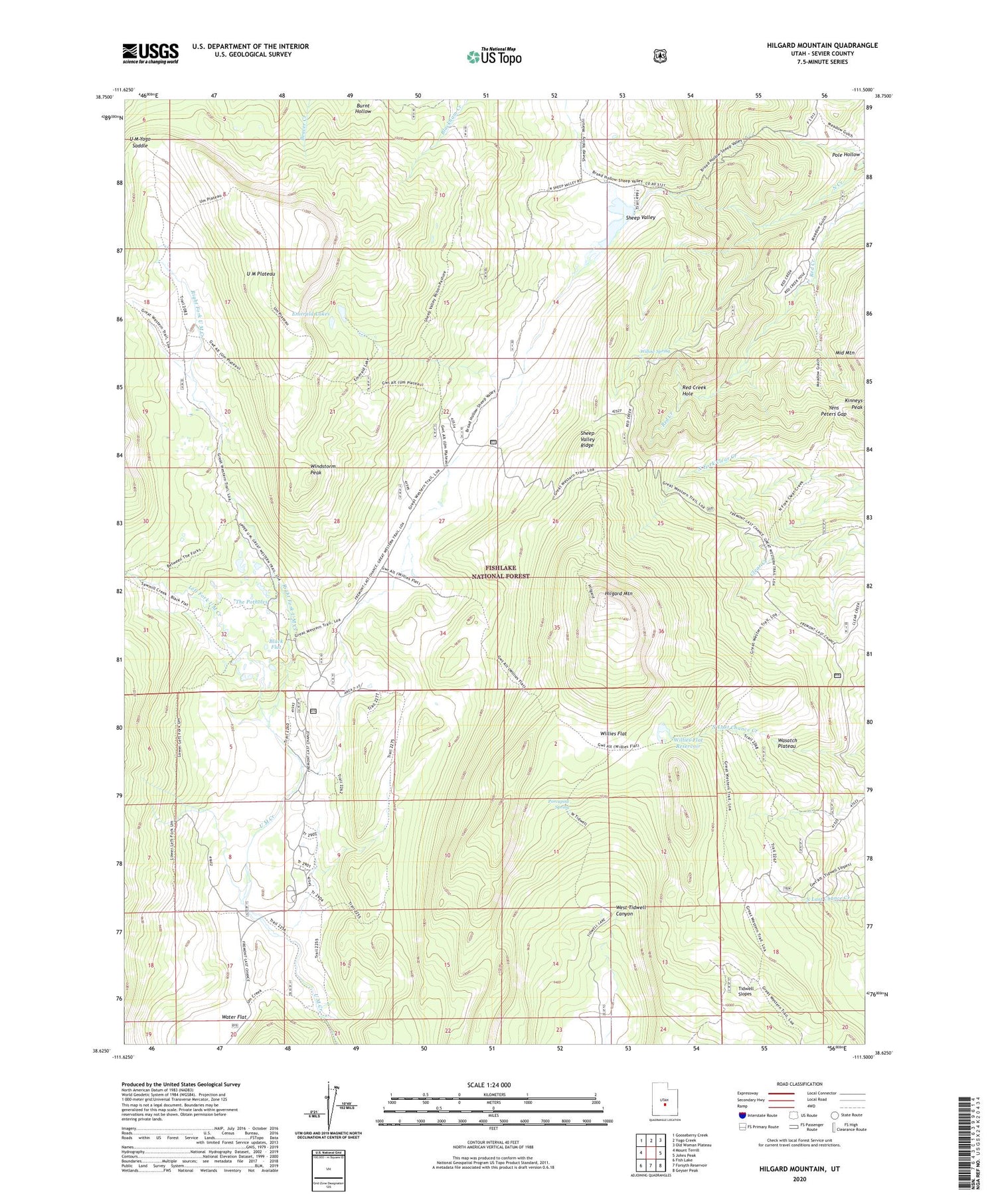
2020 topographic map quadrangle Hilgard Mountain in the state of Utah. Scale: 1:24000. Based on the newly updated USGS 7.5' US Topo map series, this map is in the following counties: Sevier. The map contains contour data, water features, and other items you are used to seeing on USGS maps, but also has updated roads and other features. This is the next generation of topographic maps. Printed on high-quality waterproof paper with UV fade-resistant inks.
Quads adjacent to this one:
West: Mount Terrill
Northwest: Gooseberry Creek
North: Yogo Creek
Northeast: Old Woman Plateau
East: Johns Peak
Southeast: Geyser Peak
South: Forsyth Reservoir
Southwest: Fish Lake
Contains the following named places: Black Flat, Burnt Hollow, Clear Creek Guard Station, Emerald Lakes, Great Western Trail, Hilgard Mountain, Left Fork U M Creek, Pole Hollow, Porcupine Spring, Red Creek Hole, Right Fork U M Creek, Sheep Valley, Sheep Valley Dam, Sheep Valley Reservoir, Sheep Valley Ridge, The Potholes, U M Plateau, U M Yogo Saddle, Water Flat, Willies Flat, Willies Flat Reservoir, Willow Spring, Windstorm Peak, Yens Peters Gap


