MyTopo
Gooseberry Creek Utah US Topo Map
Couldn't load pickup availability
Also explore the Gooseberry Creek Forest Service Topo of this same quad for updated USFS data
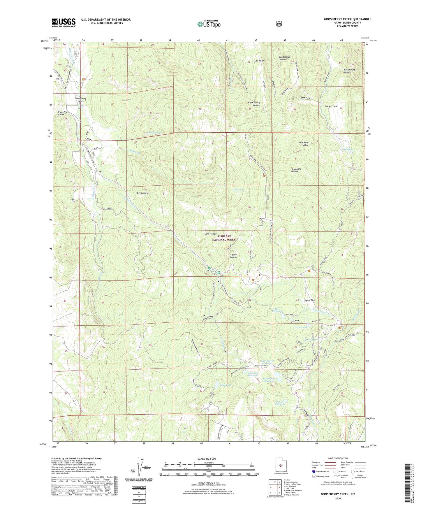
2023 topographic map quadrangle Gooseberry Creek in the state of Utah. Scale: 1:24000. Based on the newly updated USGS 7.5' US Topo map series, this map is in the following counties: Sevier. The map contains contour data, water features, and other items you are used to seeing on USGS maps, but also has updated roads and other features. This is the next generation of topographic maps. Printed on high-quality waterproof paper with UV fade-resistant inks.
Quads adjacent to this one:
West: Rex Reservoir
Northwest: Salina
North: Steves Mountain
Northeast: Water Hollow Ridge
East: Yogo Creek
Southeast: Hilgard Mountain
South: Mount Terrill
Southwest: Boobe Hole Reservoir
This map covers the same area as the classic USGS quad with code o38111g6.
Contains the following named places: Abes Creek, Abes Reservoir, Brush Trail Hollow, Catamount Canyon, Cold Spring, Creepy Spring, Farnsworth Dam, Farnsworth Reservoir, Gates Creek, Gates Lake, German Flat, Gooseberry, Gooseberry Campground, Gooseberry Ranger Station, Hamilton Reservoir, Harves River Reservoir, Hoodoo Creek, Jack Went Hollow, Long Hollow, Oak Ridge, Porcupine Creek, Salina City Dam, Salina Reservoir, Sheep Creek, Squaw Hollow, Taylor Flat, Telephone Hollow, Twin Ponds