MyTopo
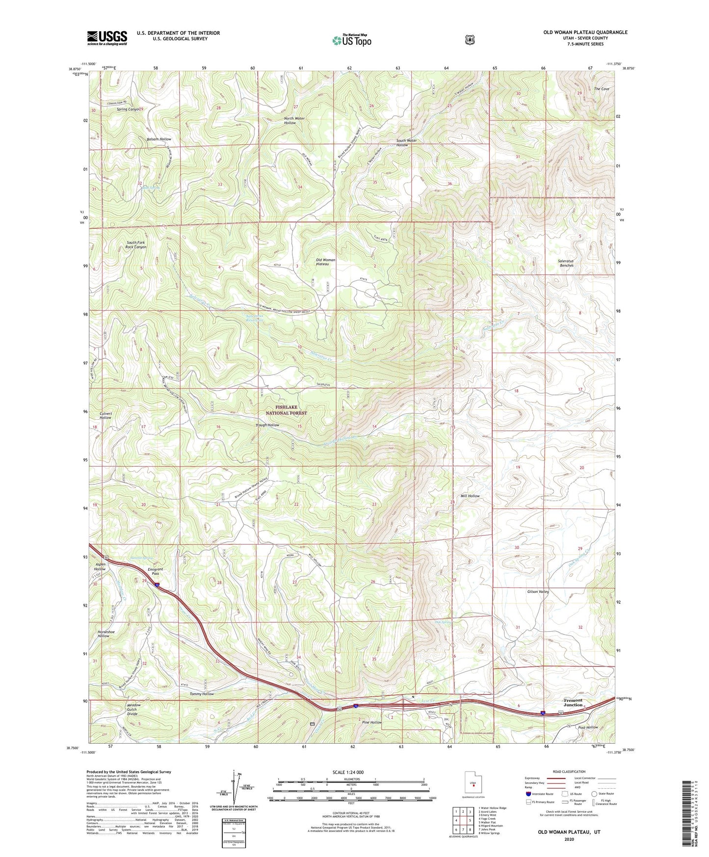
Old Woman Plateau Utah US Topo Map
Couldn't load pickup availability
Also explore the Old Woman Plateau Forest Service Topo of this same quad for updated USFS data
2023 topographic map quadrangle Old Woman Plateau in the state of Utah. Scale: 1:24000. Based on the newly updated USGS 7.5' US Topo map series, this map is in the following counties: Sevier. The map contains contour data, water features, and other items you are used to seeing on USGS maps, but also has updated roads and other features. This is the next generation of topographic maps. Printed on high-quality waterproof paper with UV fade-resistant inks.
Quads adjacent to this one:
West: Yogo Creek
Northwest: Water Hollow Ridge
North: Acord Lakes
Northeast: Emery West
East: Walker Flat
Southeast: Willow Springs
South: Johns Peak
Southwest: Hilgard Mountain
This map covers the same area as the classic USGS quad with code o38111g4.
Contains the following named places: Aspen Hollow, Balsam Hollow, Clear Creek, Coal Mine Creek, Draw Creek, Emigrant Pass, Fremont Junction, Horseshoe Hollow, Knight Mine, Meadow Gulch Divide, Mill Hollow, Mud Spring, North Creek, Oak Spring, Oak Spring Ranch, Old Woman Plateau, Pine Hollow, Red Creek, Saleratus Reservoir, Summit Spring, Tommy Hollow