MyTopo
Good Hope Bay Utah US Topo Map
Couldn't load pickup availability
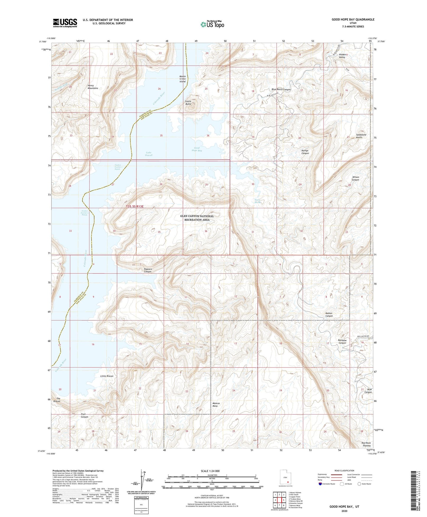
2023 topographic map quadrangle Good Hope Bay in the state of Utah. Scale: 1:24000. Based on the newly updated USGS 7.5' US Topo map series, this map is in the following counties: San Juan, Garfield. The map contains contour data, water features, and other items you are used to seeing on USGS maps, but also has updated roads and other features. This is the next generation of topographic maps. Printed on high-quality waterproof paper with UV fade-resistant inks.
Quads adjacent to this one:
West: Ticaboo Mesa
Northwest: Mount Holmes
North: Hite South
Northeast: Copper Point
East: Mancos Mesa NE
Southeast: Chocolate Drop
South: Mancos Mesa
Southwest: Knowles Canyon
This map covers the same area as the classic USGS quad with code o37110f4.
Contains the following named places: Bessie Bar, Blue Canyon, Blue Notch Canyon, Castle Butte, Good Hope Bay, Hidden Valley, Kathys Canyon, Little Rincon, Mahon Canyon, Monte Cristo Island, Popcorn Canyon, Rainbow Canyon, Red Canyon, Sandstone Knolls, The Rincon, Ticaboo Creek, Ticaboo Number 1 Rapids, Ticaboo Number 2 Rapids, Warm Spring, Wilson Canyon