MyTopo
Hunt Draw Utah US Topo Map
Couldn't load pickup availability
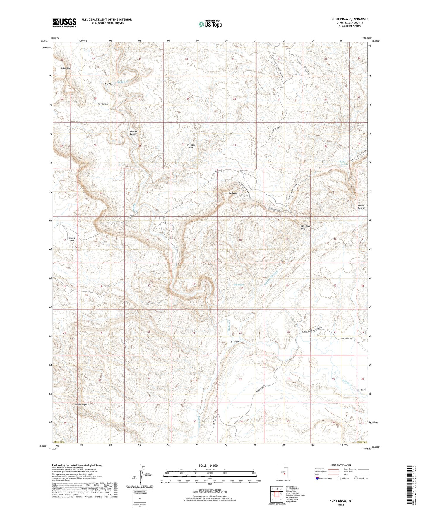
2023 topographic map quadrangle Hunt Draw in the state of Utah. Scale: 1:24000. Based on the newly updated USGS 7.5' US Topo map series, this map is in the following counties: Emery. The map contains contour data, water features, and other items you are used to seeing on USGS maps, but also has updated roads and other features. This is the next generation of topographic maps. Printed on high-quality waterproof paper with UV fade-resistant inks.
Quads adjacent to this one:
West: The Frying Pan
Northwest: Ireland Mesa
North: Tomsich Butte
Northeast: Horse Valley
East: Little Wild Horse Mesa
Southeast: Skyline Rim
South: Factory Butte
Southwest: Caine Springs
This map covers the same area as the classic USGS quad with code o38110e8.
Contains the following named places: Bullberry Spring, Chimney Canyon, Cistern Canyon, Hunt Draw, Keesle Country, Salt Wash, Segers Hole, Stinking Spring Creek, Sy Butte, The Chute, The Pasture