MyTopo
Huntington Utah US Topo Map
Couldn't load pickup availability
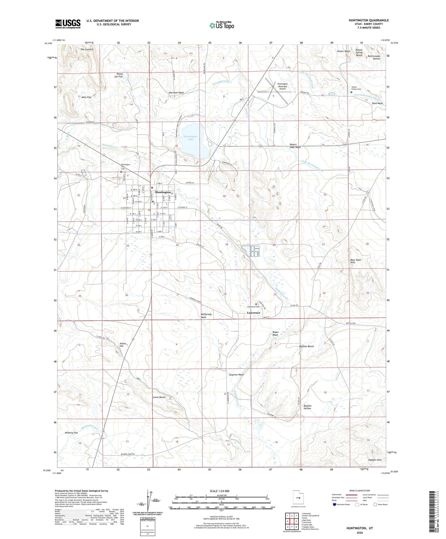
2020 topographic map quadrangle Huntington in the state of Utah. Scale: 1:24000. Based on the newly updated USGS 7.5' US Topo map series, this map is in the following counties: Emery. The map contains contour data, water features, and other items you are used to seeing on USGS maps, but also has updated roads and other features. This is the next generation of topographic maps. Printed on high-quality waterproof paper with UV fade-resistant inks.
Quads adjacent to this one:
West: Red Point
Northwest: Hiawatha
North: Poison Spring Bench
Northeast: Elmo
East: Cleveland
Southeast: Buckhorn Reservoir
South: Hadden Holes
Southwest: Castle Dale
Contains the following named places: Allens Hill, Blue Slate Hills, Buffalo Bench, Buffalo Hollow, Canyon View Junior High School, Castle Dale-Huntington Division, Cedar Creek, City of Huntington, Cleveland Canal, Cleveland Center Ditch, Cottonwood Creek Huntington Canal, Guymon Wash, Hadden Hills, Huntington, Huntington Campground, Huntington Canal, Huntington City Cemetery, Huntington Elementary School, Huntington Fire Department, Huntington Lake, Huntington Municipal Airport, Huntington Post Office, Huntington State Park, Lawrence, Lawrence Cemetery, Level Bench, Mammoth Canal, McElprang Wash, Mills Flat, North Ditch, Nosey Joe Flat, Potter Wash, Rattlesnake Hollow, Roper Wash, Sherman Wash, South Branch Cleveland Canal, The Church of Jesus Christ of Latter Day Saints, The Gumhill, Tucker Family Cemetery