MyTopo
Buckhorn Reservoir Utah US Topo Map
Couldn't load pickup availability
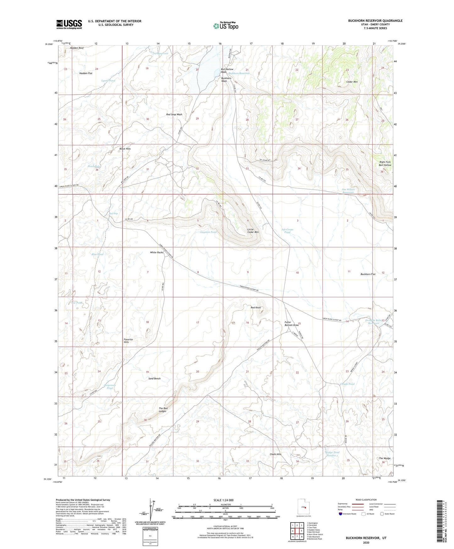
2023 topographic map quadrangle Buckhorn Reservoir in the state of Utah. Scale: 1:24000. Based on the newly updated USGS 7.5' US Topo map series, this map is in the following counties: Emery. The map contains contour data, water features, and other items you are used to seeing on USGS maps, but also has updated roads and other features. This is the next generation of topographic maps. Printed on high-quality waterproof paper with UV fade-resistant inks.
Quads adjacent to this one:
West: Hadden Holes
Northwest: Huntington
North: Cleveland
Northeast: Cow Flats
East: Bob Hill Knoll
Southeast: Bottleneck Peak
South: Sids Mountain
Southwest: Horn Silver Gulch
This map covers the same area as the classic USGS quad with code o39110b7.
Contains the following named places: Blue Pond, Buckhorn Dam, Buckhorn Flat, Buckhorn Reservoir, Buckhorn Well, Bull Hollow Wash, Cat Pond, Chalk Hills, Cloyds Pond, Drought Relief Reservoir, Favorite Hills, Guymon Pond, Hadden Reef, J J Reservoir, Jim Wilson Reservoir, Job Corps Pond, Jorgensen Pond, Little Cedar Mountain, Lynns Pond, Petes Hole, Red Knoll, Red Seep, Sand Bench, Sand Pond, The Red Ledges, Wedge Overlook, Wedge Pond Number 1, White Rocks