MyTopo
Elmo Utah US Topo Map
Couldn't load pickup availability
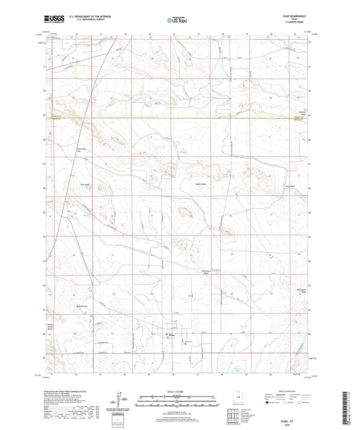
2023 topographic map quadrangle Elmo in the state of Utah. Scale: 1:24000. Based on the newly updated USGS 7.5' US Topo map series, this map is in the following counties: Emery, Carbon. The map contains contour data, water features, and other items you are used to seeing on USGS maps, but also has updated roads and other features. This is the next generation of topographic maps. Printed on high-quality waterproof paper with UV fade-resistant inks.
Quads adjacent to this one:
West: Poison Spring Bench
Northwest: Pinnacle Peak
North: Price
Northeast: Wellington
East: Olsen Reservoir
Southeast: Cow Flats
South: Cleveland
Southwest: Huntington
This map covers the same area as the classic USGS quad with code o39110d7.
Contains the following named places: Elmo, Elmo Branch Cleveland Canal, Elmo Cemetery, Elmo Fire Department, Elmo Post Office, Intermountain Sprayers Airport, North Branch Cleveland Canal, The Church of Jesus Christ of Latter Day Saints, Town of Elmo, Twin Peaks, Twin Peaks Flat, Twin Peaks Wash, Wildcat Draw, ZIP Code: 84521