MyTopo
Indian Springs Utah US Topo Map
Couldn't load pickup availability
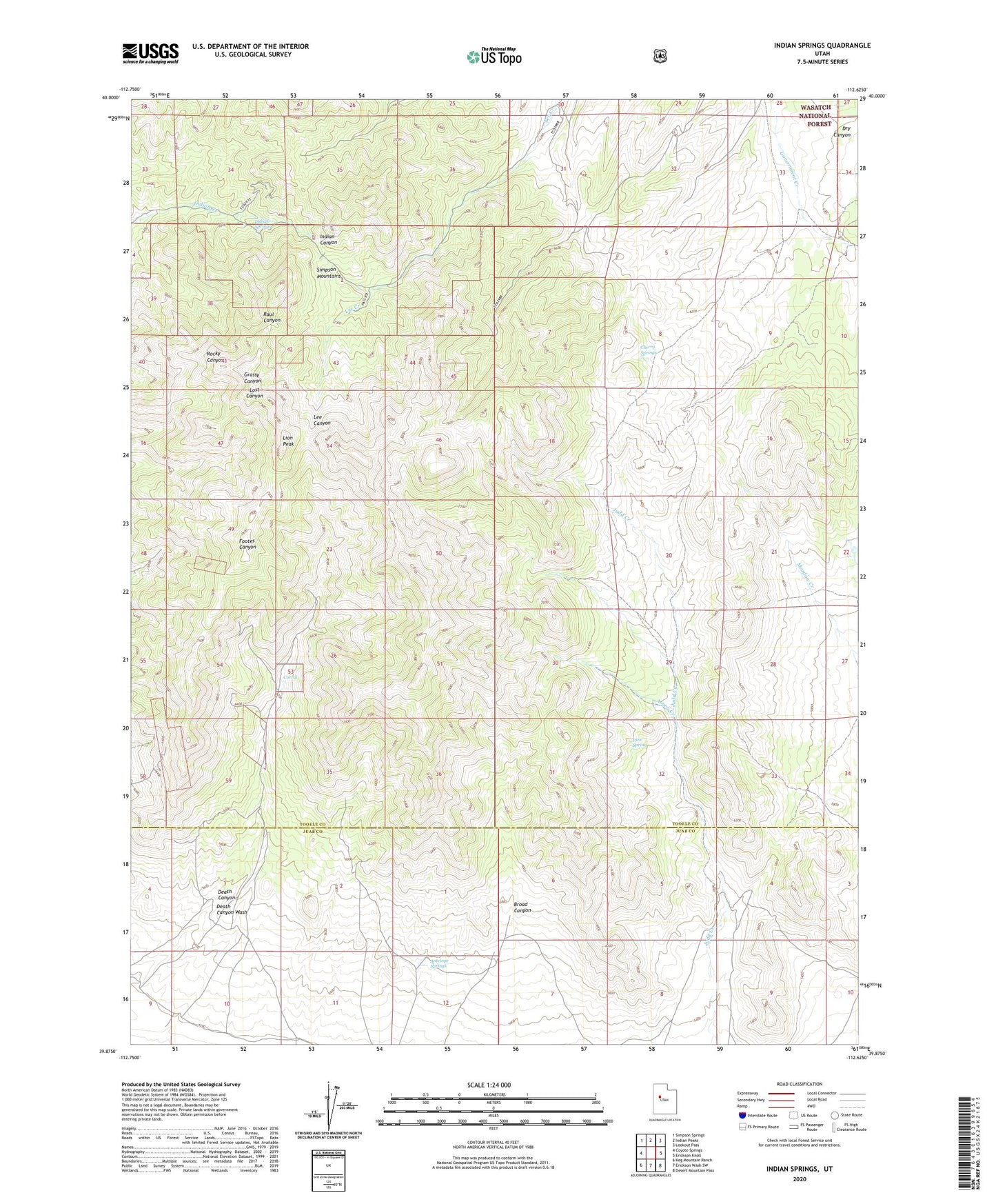
2020 topographic map quadrangle Indian Springs in the state of Utah. Scale: 1:24000. Based on the newly updated USGS 7.5' US Topo map series, this map is in the following counties: Tooele, Juab. The map contains contour data, water features, and other items you are used to seeing on USGS maps, but also has updated roads and other features. This is the next generation of topographic maps. Printed on high-quality waterproof paper with UV fade-resistant inks.
Quads adjacent to this one:
West: Coyote Springs
Northwest: Simpson Springs
North: Indian Peaks
Northeast: Lookout Pass
East: Erickson Knoll
Southeast: Desert Mountain Pass
South: Erickson Wash SW
Southwest: Keg Mountain Ranch
Contains the following named places: Antelope Springs, Aspen Creek, Bar X Mine, Broad Canyon, Cherry Springs, Corral, Death Canyon, Indian Springs, Iron Spring, Lee Canyon, Lion Peak, O P Rockwell Ranch, Simpson Mountains