MyTopo
Lookout Pass Utah US Topo Map
Couldn't load pickup availability
Also explore the Lookout Pass Forest Service Topo of this same quad for updated USFS data
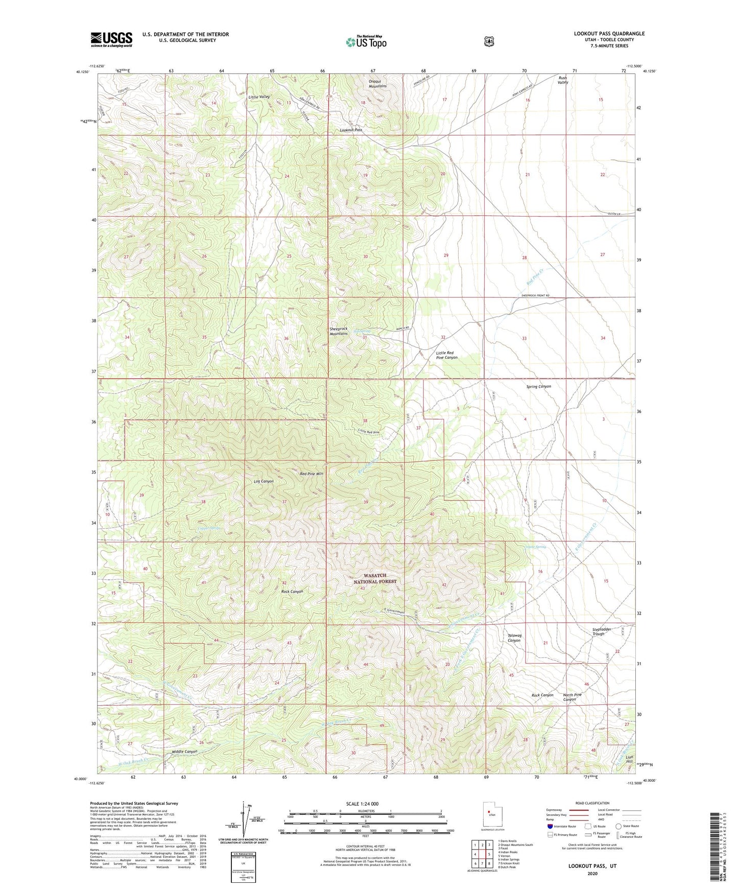
2023 topographic map quadrangle Lookout Pass in the state of Utah. Scale: 1:24000. Based on the newly updated USGS 7.5' US Topo map series, this map is in the following counties: Tooele. The map contains contour data, water features, and other items you are used to seeing on USGS maps, but also has updated roads and other features. This is the next generation of topographic maps. Printed on high-quality waterproof paper with UV fade-resistant inks.
Quads adjacent to this one:
West: Indian Peaks
Northwest: Davis Knolls
North: Onaqui Mountains South
Northeast: Faust
East: Vernon
Southeast: Dutch Peak
South: Erickson Knoll
Southwest: Indian Springs
This map covers the same area as the classic USGS quad with code o40112a5.
Contains the following named places: Copper Spring, Coyote Spring, Hill Spring, Little Red Pine Canyon, Little Valley, Lookout Pass, Lookout Pass Pony Express Station, Middle Canyon, North Pine Canyon, Red Pine Mountain, Rock Canyon, South Fork East Government Creek, Spring Canyon, Stepladder Trough, Talawag Canyon, West Well