
MyTopo
Ireland Mesa Utah US Topo Map
Couldn't load pickup availability
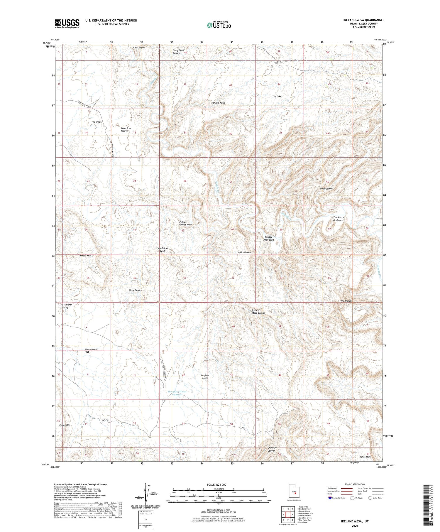
2020 topographic map quadrangle Ireland Mesa in the state of Utah. Scale: 1:24000. Based on the newly updated USGS 7.5' US Topo map series, this map is in the following counties: Emery. The map contains contour data, water features, and other items you are used to seeing on USGS maps, but also has updated roads and other features. This is the next generation of topographic maps. Printed on high-quality waterproof paper with UV fade-resistant inks.
Quads adjacent to this one:
West: Mussentuchit Flat
Northwest: Mesa Butte
North: Big Bend Draw
Northeast: Copper Globe
East: Tomsich Butte
Southeast: Hunt Draw
South: The Frying Pan
Southwest: Salvation Creek
Contains the following named places: Cat Canyon, Dizzy Trail Canyon, Hebe Canyon, Hebes Mountain, Ireland Mesa, Ireland Mesa Canyon, Lone Tree Wedge, Pitchforth Spring, Poncho Wash, Poor Canyon, Prickly Pear Bend, Slaughter Slopes, Slaughter Slopes Reservoir, The Dike, The Hondu, The Merry-Go-Round, The Wedge, Willow Springs Wash


