MyTopo
Big Bend Draw Utah US Topo Map
Couldn't load pickup availability
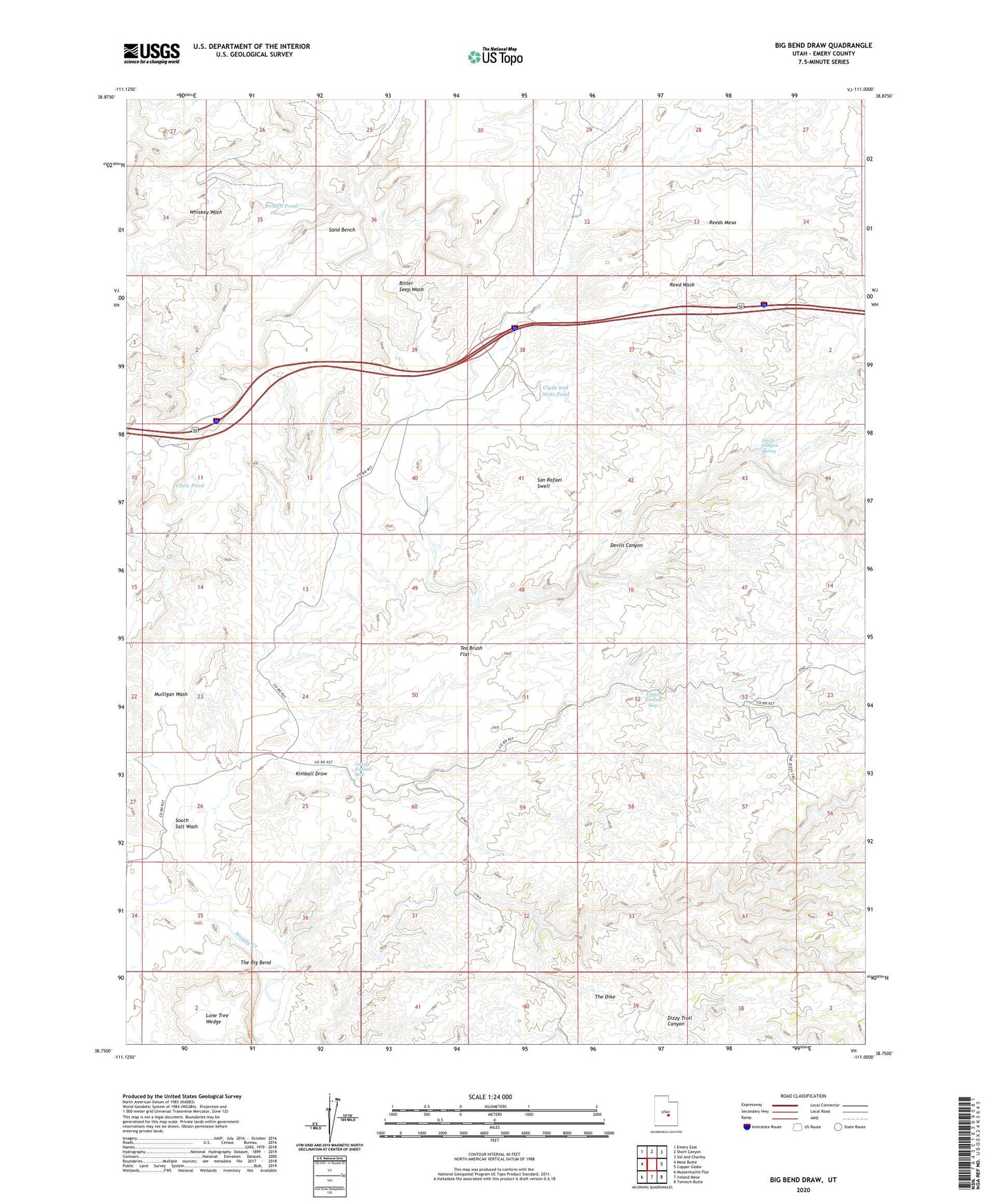
2023 topographic map quadrangle Big Bend Draw in the state of Utah. Scale: 1:24000. Based on the newly updated USGS 7.5' US Topo map series, this map is in the following counties: Emery. The map contains contour data, water features, and other items you are used to seeing on USGS maps, but also has updated roads and other features. This is the next generation of topographic maps. Printed on high-quality waterproof paper with UV fade-resistant inks.
Quads adjacent to this one:
West: Mesa Butte
Northwest: Emery East
North: Short Canyon
Northeast: Sid And Charley
East: Copper Globe
Southeast: Tomsich Butte
South: Ireland Mesa
Southwest: Mussentuchit Flat
This map covers the same area as the classic USGS quad with code o38111g1.
Contains the following named places: Bitter Seep Wash, Broken Pond, Chris Pond, Clyde and Neils Pond, Dennises Well, Devils Canyon, Devils Canyon Spring, Kimball Draw, Lane Tree, Lower Kimball Seep, Mulligan Wash, Reed Wash, Reeds Mesa, Sand Bench, South Salt Wash, Tea Brush Flat, The Big Bend, Upper Kimball Seep, Whiskey Wash