MyTopo
Johnson Pass Utah US Topo Map
Couldn't load pickup availability
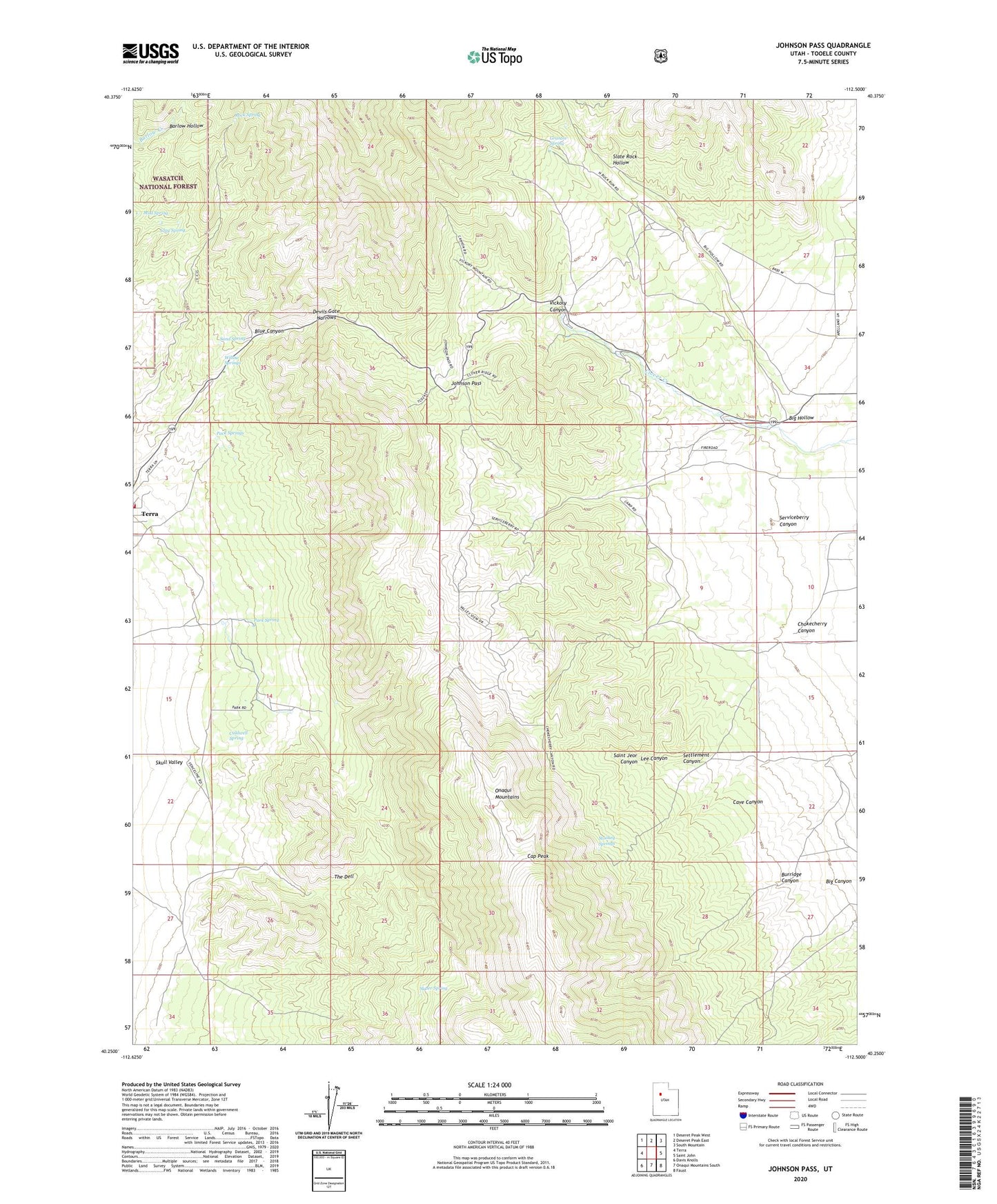
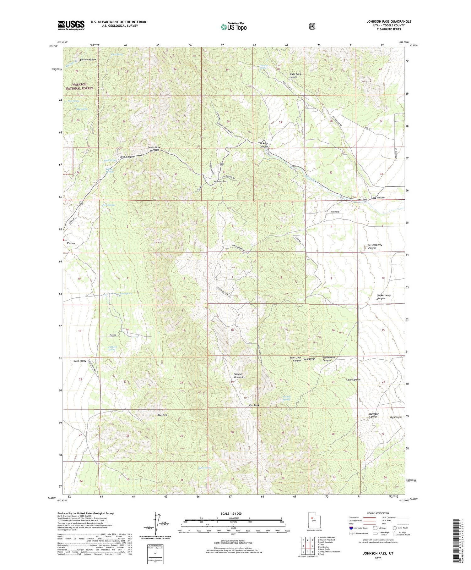
2020 topographic map quadrangle Johnson Pass in the state of Utah. Scale: 1:24000. Based on the newly updated USGS 7.5' US Topo map series, this map is in the following counties: Tooele. The map contains contour data, water features, and other items you are used to seeing on USGS maps, but also has updated roads and other features. This is the next generation of topographic maps. Printed on high-quality waterproof paper with UV fade-resistant inks.
Quads adjacent to this one:
West: Terra
Northwest: Deseret Peak West
North: Deseret Peak East
Northeast: South Mountain
East: Saint John
Southeast: Faust
South: Onaqui Mountains South
Southwest: Davis Knolls
Contains the following named places: Ahlstrom Mine, Big Canyon, Big Hollow, Blue Canyon, Burridge Canyon, Caldwell Spring, Cap Peak, Cave Canyon, Chokecherry Canyon, Clay Spring, Devils Gate Narrows, Grantee Spring, Johnson Pass, Lee Canyon, Mud Spring, Pack Springs, Park Spring, Rock Spring, Saint Jeor Canyon, Sand Spring, Serviceberry Canyon, Settlement Canyon, Slate Rock Hollow, Slater Spring, Stookey Springs, Terra Volunteer Fire Department, The Dell, Vickory Canyon, Willow Springs