MyTopo
Davis Knolls Utah US Topo Map
Couldn't load pickup availability
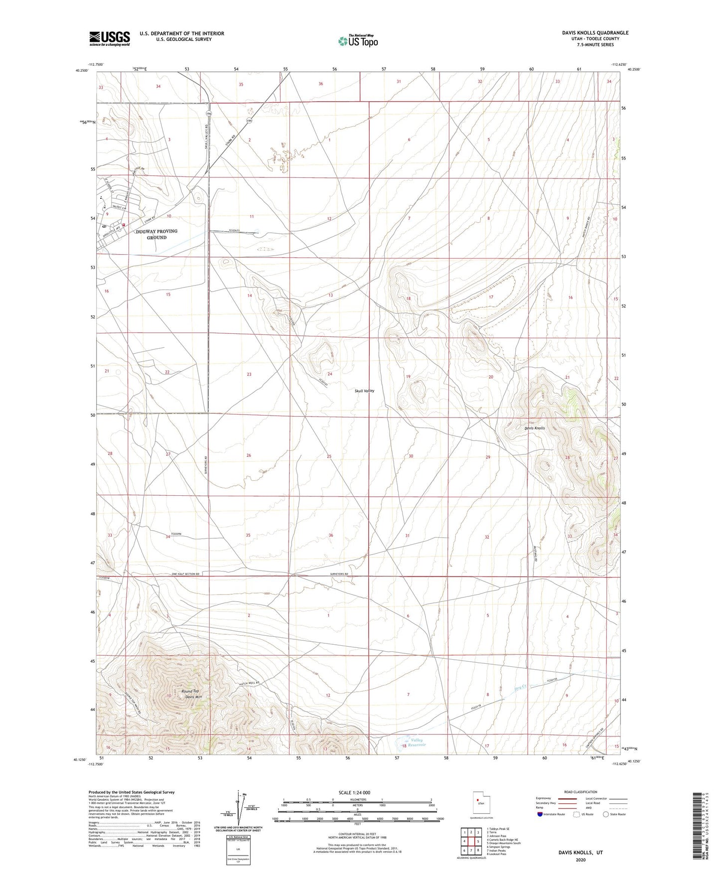
2023 topographic map quadrangle Davis Knolls in the state of Utah. Scale: 1:24000. Based on the newly updated USGS 7.5' US Topo map series, this map is in the following counties: Tooele. The map contains contour data, water features, and other items you are used to seeing on USGS maps, but also has updated roads and other features. This is the next generation of topographic maps. Printed on high-quality waterproof paper with UV fade-resistant inks.
Quads adjacent to this one:
West: Camels Back Ridge NE
Northwest: Tabbys Peak SE
North: Terra
Northeast: Johnson Pass
East: Onaqui Mountains South
Southeast: Lookout Pass
South: Indian Peaks
Southwest: Simpson Springs
This map covers the same area as the classic USGS quad with code o40112b6.
Contains the following named places: Davis Knolls, Davis Mountain, Dry Creek, Dugway, Dugway Elementary School, Dugway Fire Department, Dugway High School, Dugway Post Office, Hatch Well, Round Top, The Church of Jesus Christ of Latter Day Saints, Valley Reservoir