MyTopo
Faust Utah US Topo Map
Couldn't load pickup availability
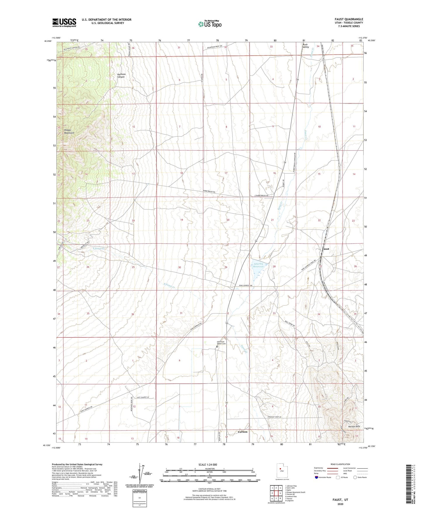
2023 topographic map quadrangle Faust in the state of Utah. Scale: 1:24000. Based on the newly updated USGS 7.5' US Topo map series, this map is in the following counties: Tooele. The map contains contour data, water features, and other items you are used to seeing on USGS maps, but also has updated roads and other features. This is the next generation of topographic maps. Printed on high-quality waterproof paper with UV fade-resistant inks.
Quads adjacent to this one:
West: Onaqui Mountains South
Northwest: Johnson Pass
North: Saint John
Northeast: Ophir
East: Vernon NE
Southeast: Lofgreen
South: Vernon
Southwest: Lookout Pass
This map covers the same area as the classic USGS quad with code o40112b4.
Contains the following named places: Atherley Dam, Atherley Reservoir, East Faust Creek, Faust, Hellhole Canyon, Historical Marker Faust Pony Express Station, Lookout Pass Trail Well, Old Faust Ranch Cemetery, Vernon Hills