
MyTopo
Jordan Narrows Utah US Topo Map
Couldn't load pickup availability
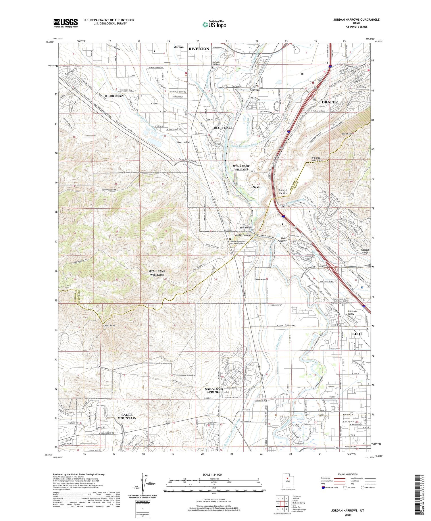
2023 topographic map quadrangle Jordan Narrows in the state of Utah. Scale: 1:24000. Based on the newly updated USGS 7.5' US Topo map series, this map is in the following counties: Salt Lake, Utah. The map contains contour data, water features, and other items you are used to seeing on USGS maps, but also has updated roads and other features. This is the next generation of topographic maps. Printed on high-quality waterproof paper with UV fade-resistant inks.
Quads adjacent to this one:
West: Tickville Spring
Northwest: Copperton
North: Midvale
Northeast: Draper
East: Lehi
Southeast: Pelican Point
South: Saratoga Springs
Southwest: Cedar Fort
This map covers the same area as the classic USGS quad with code o40111d8.
Contains the following named places: Avalon Estates, Beef Hollow, Bluffdale, Bluffdale City Cemetery, Bluffdale Elementary School, Bluffdale Fire Department, Camp Williams Airfield, Camp Williams Heliport, Camp Williams Utah Army National Guard, Cedar Point, City of Bluffdale, Clinton, Country Living, Draper Canal, Gardiner Estates, Genesis Youth Center, Johnson Anderson, Jordan, Jordan Narrows, Jordan Valley Water Purification Dam, Jordan Valley Water Purification Reservoir, Lewis Estates, Mesa, Mount, Moyal Anderson, Nash, Oak Hollow, Olivers, Point of the Mountain, Rideout, Saratoga Canal, Saratoga Springs Unified Fire Department and Emergency Medical Services, South Bluff Estates, State of Utah Lone Peak Fire Center, Steep Mountain, The Church of Jesus Christ of Latter Day Saints, Traverse Mountains, Unified Fire Authority Fire Station 114, Utah Lake Distributing Canal, Utah State Prison, Utah State Prison Heliport, Utah Veterans Cemetery and Memorial Park, Wood Hollow, ZIP Codes: 84043, 84065


