MyTopo
Saratoga Springs Utah US Topo Map
Couldn't load pickup availability
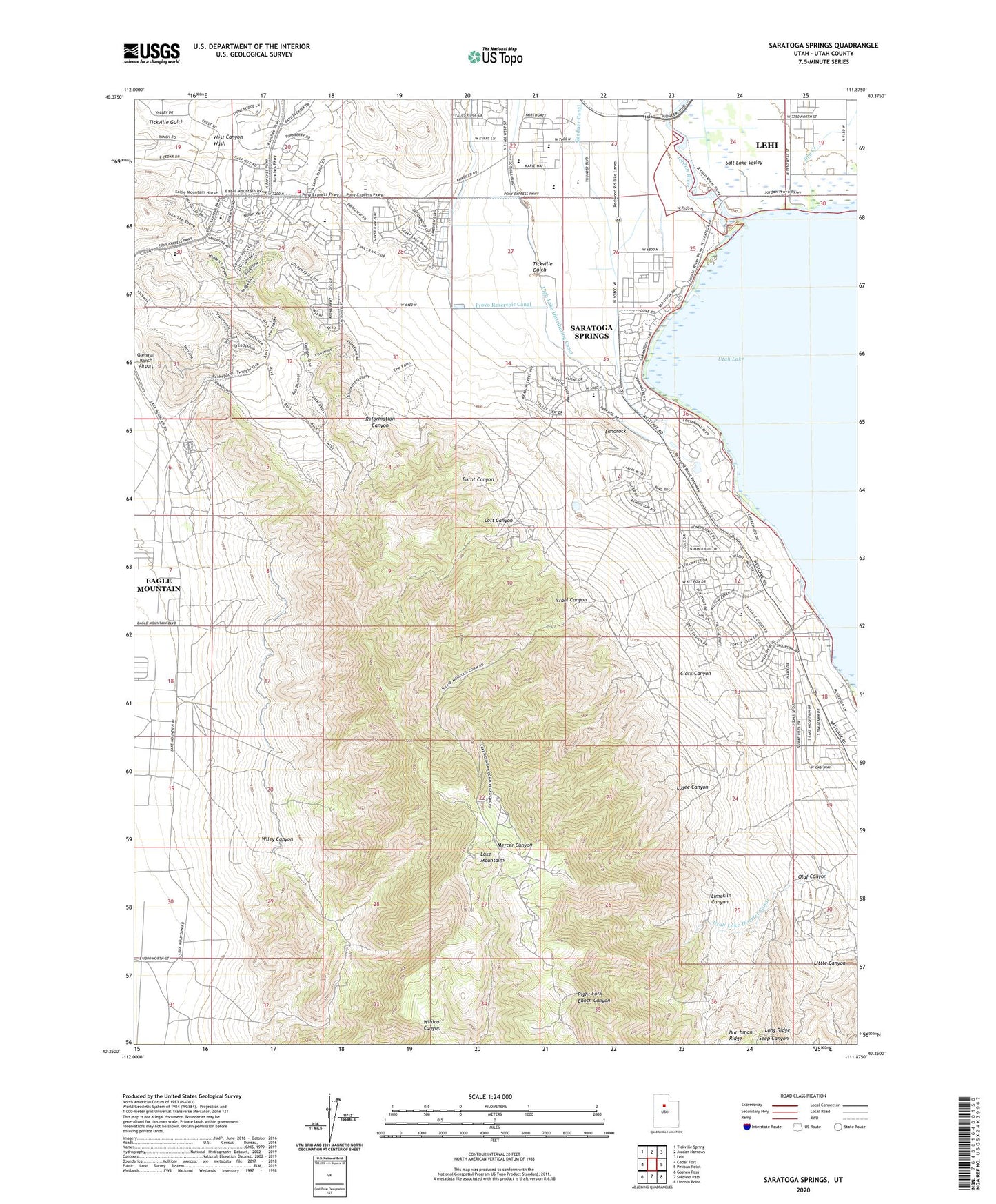
2023 topographic map quadrangle Saratoga Springs in the state of Utah. Scale: 1:24000. Based on the newly updated USGS 7.5' US Topo map series, this map is in the following counties: Utah. The map contains contour data, water features, and other items you are used to seeing on USGS maps, but also has updated roads and other features. This is the next generation of topographic maps. Printed on high-quality waterproof paper with UV fade-resistant inks.
Quads adjacent to this one:
West: Cedar Fort
Northwest: Tickville Spring
North: Jordan Narrows
Northeast: Lehi
East: Pelican Point
Southeast: Lincoln Point
South: Soldiers Pass
Southwest: Goshen Pass
This map covers the same area as the classic USGS quad with code o40111c8.
Contains the following named places: Burnt Canyon, City of Saratoga Springs, Clark Canyon, Dry Creek, Gardner Canal, Glenmar Ranch Airport, Israel Canyon, KABE-FM (Orem), KFMY-FM (Provo), KLRZ-FM (Provo), Lake Mountains, Landrock, Limekiln Canyon, Little Canyon, Long Ridge, Losee Canyon, Lott Canyon, Murdock Pumping Station, Olaf Canyon, Reformation Canyon, Saratoga, Saratoga Resort, Saratoga Resort Airport, Saratoga Springs, Tickville Gulch, Unified Fire Authority Fire Station 252 - Eagle Mountain, Webb Cedars, West Canyon Wash, Wiley Canyon, ZIP Codes: 84005, 84045