MyTopo
Joseph Peak Utah US Topo Map
Couldn't load pickup availability
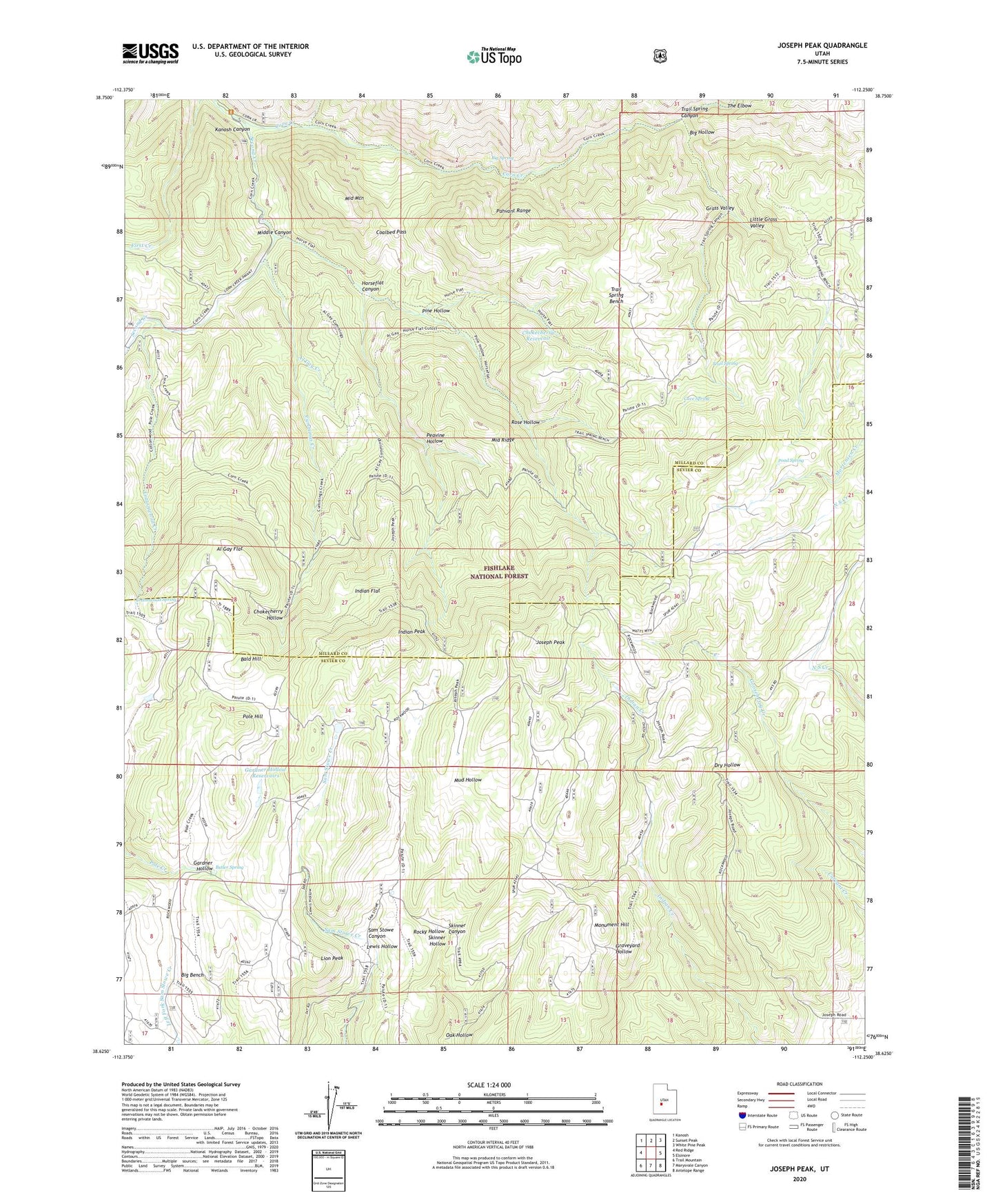
2020 topographic map quadrangle Joseph Peak in the state of Utah. Scale: 1:24000. Based on the newly updated USGS 7.5' US Topo map series, this map is in the following counties: Millard, Sevier. The map contains contour data, water features, and other items you are used to seeing on USGS maps, but also has updated roads and other features. This is the next generation of topographic maps. Printed on high-quality waterproof paper with UV fade-resistant inks.
Quads adjacent to this one:
West: Red Ridge
Northwest: Kanosh
North: Sunset Peak
Northeast: White Pine Peak
East: Elsinore
Southeast: Antelope Range
South: Marysvale Canyon
Southwest: Trail Mountain
Contains the following named places: Al Gay Creek, Al Gay Flat, Bald Hill, Big Hollow, Big Spring, Butler Spring, Cave Spring, Chokecherry Hollow, Chokecherry Reservoir, Coalbed Pass, Cottonwood Creek, Cottonwood Spring, Cummings Creek, Gardner Hollow, Gardner Hollow Reservoirs, Grass Valley, Horseflat Canyon, Indian Flat, Indian Peak, Joseph Peak, Lewis Hollow, Lion Peak, Little Grass Valley, Middle Canyon, Middle Mountain, Middle Ridge, Monk Spring Creek, Monument Hill, Mud Hollow, Oak Hollow, Parker Ranch, Peavine Hollow, Pine Hollow, Pole Hill, Pond Spring, Rockwood Ranger Station, Rocky Hollow, Rose Hollow, Second Creek, Skinner Hollow, The Elbow, Trail Spring, Trail Spring Bench, Trail Spring Canyon