MyTopo
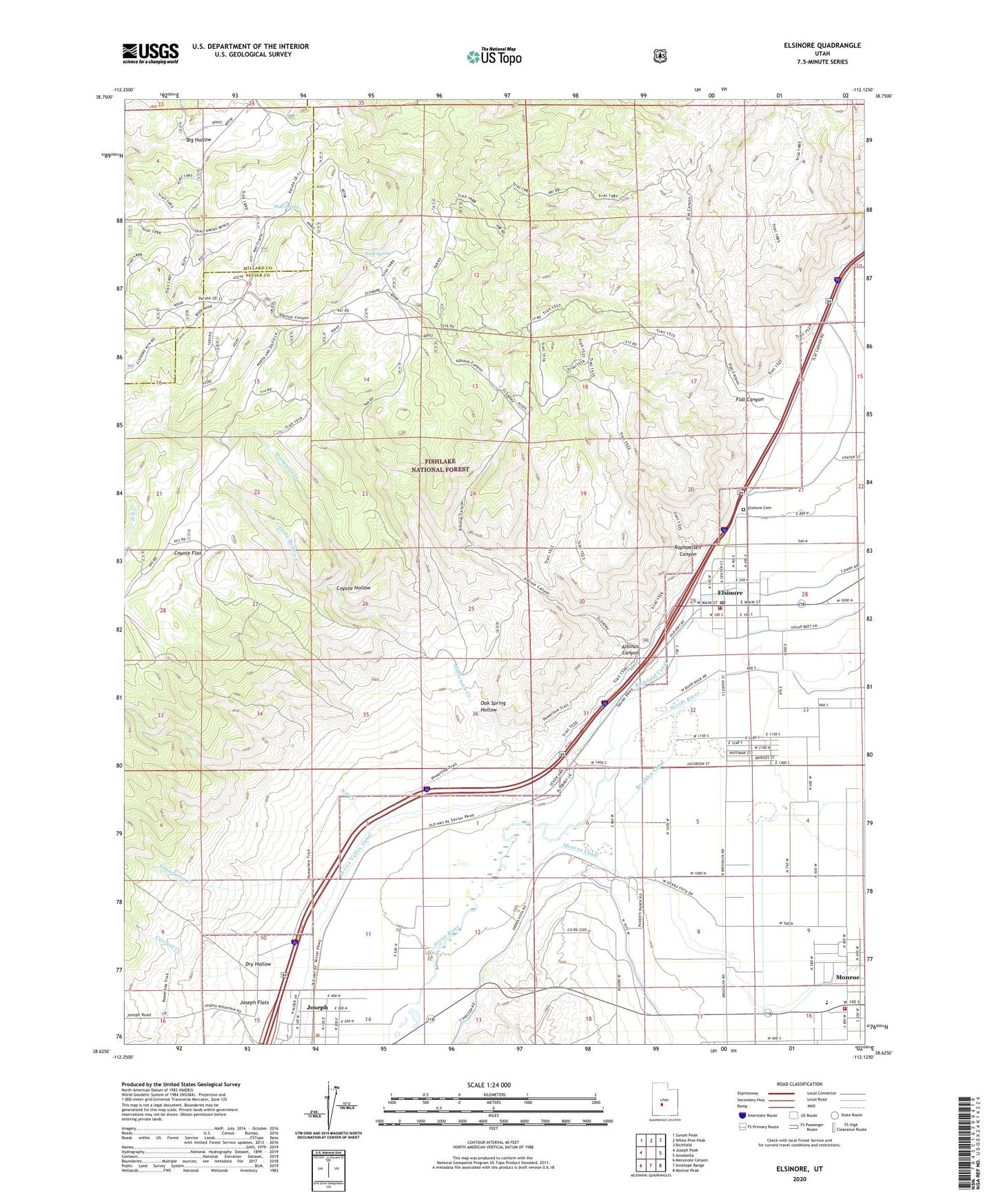
Elsinore Utah US Topo Map
Couldn't load pickup availability
Also explore the Elsinore Forest Service Topo of this same quad for updated USFS data
2023 topographic map quadrangle Elsinore in the state of Utah. Scale: 1:24000. Based on the newly updated USGS 7.5' US Topo map series, this map is in the following counties: Sevier, Millard. The map contains contour data, water features, and other items you are used to seeing on USGS maps, but also has updated roads and other features. This is the next generation of topographic maps. Printed on high-quality waterproof paper with UV fade-resistant inks.
Quads adjacent to this one:
West: Joseph Peak
Northwest: Sunset Peak
North: White Pine Peak
Northeast: Richfield
East: Annabella
Southeast: Monroe Peak
South: Antelope Range
Southwest: Marysvale Canyon
This map covers the same area as the classic USGS quad with code o38112f2.
Contains the following named places: Albinus Canyon, Brooklyn Canal, Coyote Flat, Coyote Hollow, Coyote Hollow Creek, Currant Creek, Dry Hollow, Elsinore, Elsinore Cemetery, Elsinore Fire Department, Elsinore Post Office, Flat Canyon, Gooseberry Creek, Joseph, Joseph Flats, Monroe City Fire Department, Mortensen Creek, Mud Spring, North South Creek, Oak Spring Hollow, Raphaelsen Canyon, Rock Spring, Rocky Trail, Sevier Valley Canal, The Church of Jesus Christ of Latter Day Saints, Town of Elsinore, ZIP Codes: 84724, 84739