MyTopo
Kanosh Utah US Topo Map
Couldn't load pickup availability
Also explore the Kanosh Forest Service Topo of this same quad for updated USFS data
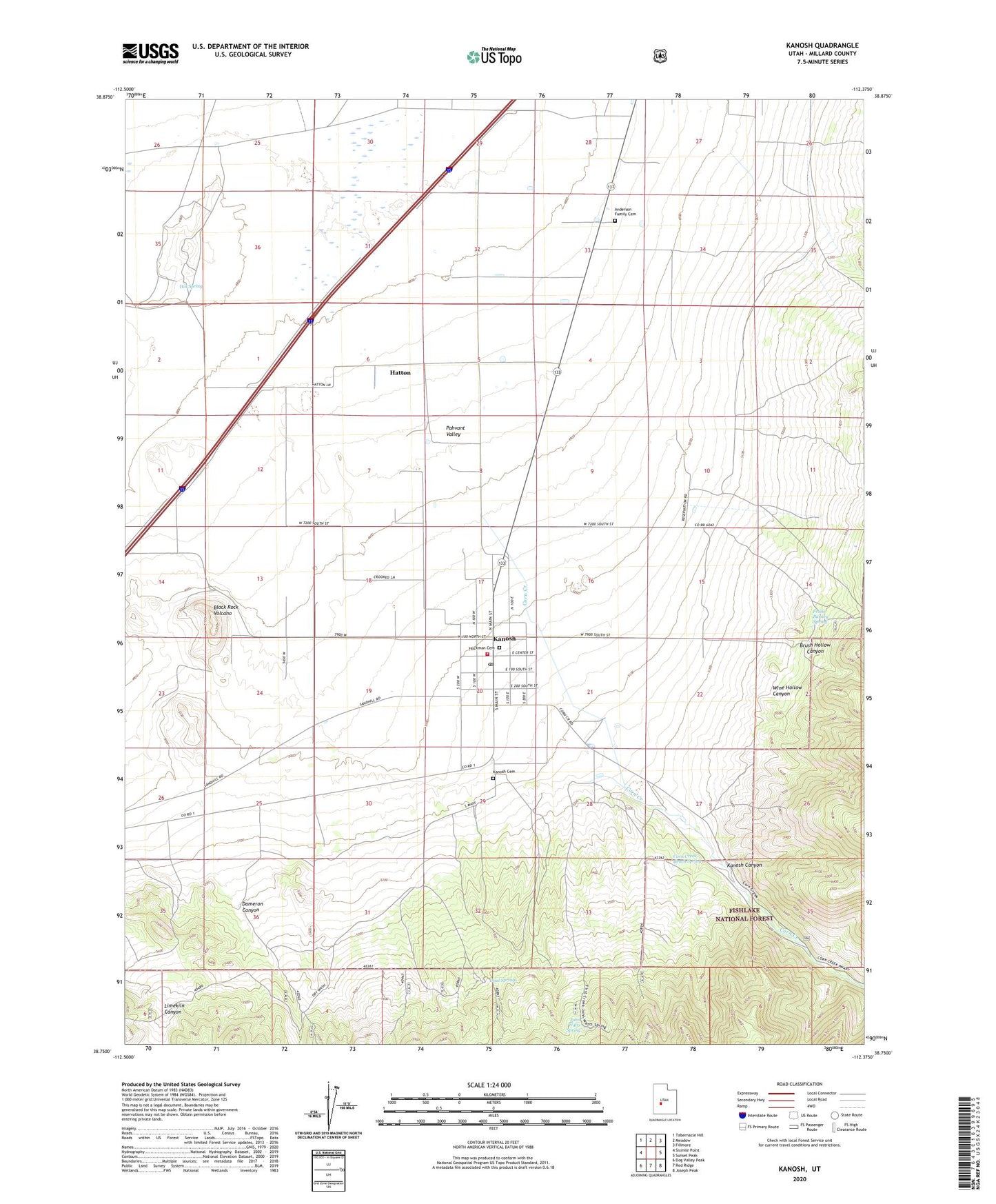
2023 topographic map quadrangle Kanosh in the state of Utah. Scale: 1:24000. Based on the newly updated USGS 7.5' US Topo map series, this map is in the following counties: Millard. The map contains contour data, water features, and other items you are used to seeing on USGS maps, but also has updated roads and other features. This is the next generation of topographic maps. Printed on high-quality waterproof paper with UV fade-resistant inks.
Quads adjacent to this one:
West: Sixmile Point
Northwest: Tabernacle Hill
North: Meadow
Northeast: Fillmore
East: Sunset Peak
Southeast: Joseph Peak
South: Red Ridge
Southwest: Dog Valley Peak
This map covers the same area as the classic USGS quad with code o38112g4.
Contains the following named places: Anderson Family Cemetery, Black Rock Volcano, Brush Hollow Canyon, Corn Creek, Corn Creek Bench Spring, Corn Creek Wildlife Management Area, Dameron Canyon, Dual Springs, Frank Barney Spring, Hatton, Hockman Cemetery, Hot Spring, John Watts Spring, Kanosh, Kanosh Canyon, Kanosh Cemetery, Kanosh Indian Reservation, Kanosh Indian Village, Kanosh Indian Village Cemetery, Kanosh Post Office, Kanosh Volunteer Fire Department, Kanosh Wildlife Management Area, Limekiln Canyon, Rock Corral Quarry, The Church of Jesus Christ of Latter Day Saints, Town of Kanosh, Wine Hollow Canyon