MyTopo
Lady Laird Peak Utah US Topo Map
Couldn't load pickup availability
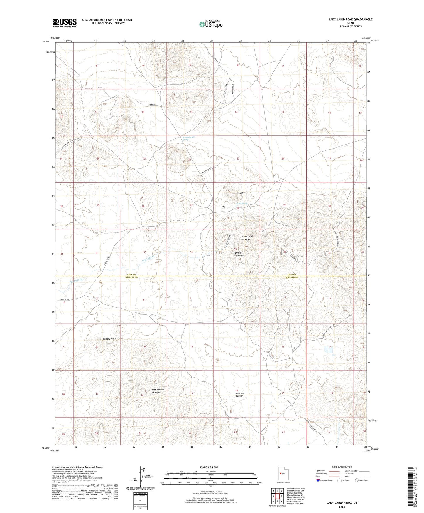
2023 topographic map quadrangle Lady Laird Peak in the state of Utah. Scale: 1:24000. Based on the newly updated USGS 7.5' US Topo map series, this map is in the following counties: Juab, Millard. The map contains contour data, water features, and other items you are used to seeing on USGS maps, but also has updated roads and other features. This is the next generation of topographic maps. Printed on high-quality waterproof paper with UV fade-resistant inks.
Quads adjacent to this one:
West: Topaz Mountain SW
Northwest: Topaz Mountain West
North: Topaz Mountain East
Northeast: Picture Rock Hills
East: Drum Mountains Well
Southeast: Smelter Knolls West
South: Little Drum Pass
Southwest: Whirlwind Valley NW
This map covers the same area as the classic USGS quad with code o39113e1.
Contains the following named places: Black Boy Mine, Detroit Mountains, Drum Mine, Freighters Well, Ibex Mine, Joy, Lady Laird Peak, Laird Spring, Mount Laird, Schoenburger Spring