MyTopo
Lampo Junction Utah US Topo Map
Couldn't load pickup availability
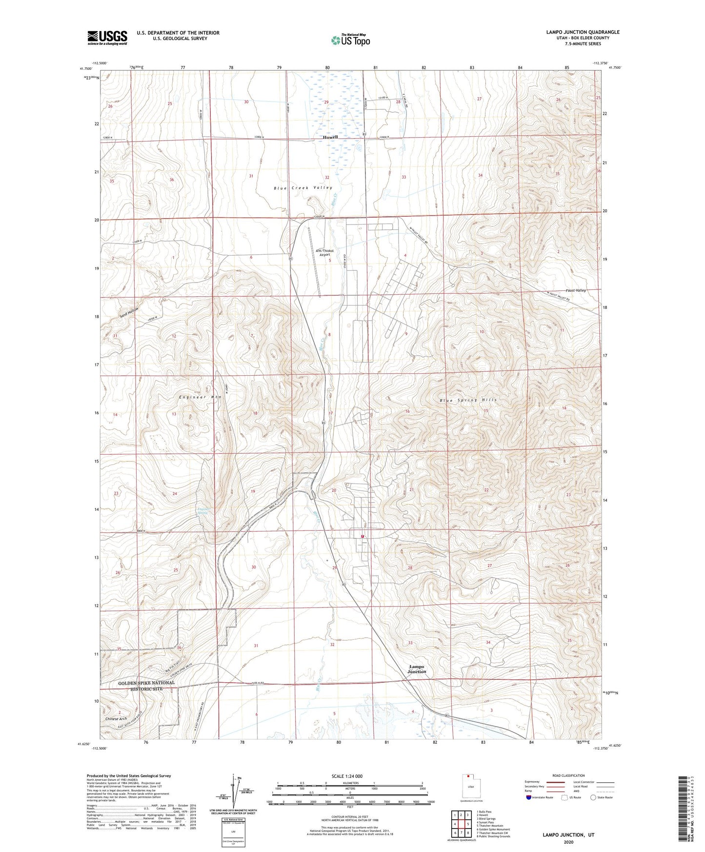
2020 topographic map quadrangle Lampo Junction in the state of Utah. Scale: 1:24000. Based on the newly updated USGS 7.5' US Topo map series, this map is in the following counties: Box Elder. The map contains contour data, water features, and other items you are used to seeing on USGS maps, but also has updated roads and other features. This is the next generation of topographic maps. Printed on high-quality waterproof paper with UV fade-resistant inks.
Quads adjacent to this one:
West: Sunset Pass
Northwest: Bulls Pass
North: Howell
Northeast: Blind Springs
East: Thatcher Mountain
Southeast: Public Shooting Grounds
South: Thatcher Mountain SW
Southwest: Golden Spike Monument
Contains the following named places: Alliant Techsystems Fire Station, ATK/Thiokol Airport, Blue Creek Valley, Chinese Arch, Engineer Mountain, Engineer Spring, Golden Spike National Historic Site, Lampo Junction, Sand Hollow, Surbon