MyTopo
Thatcher Mountain Utah US Topo Map
Couldn't load pickup availability
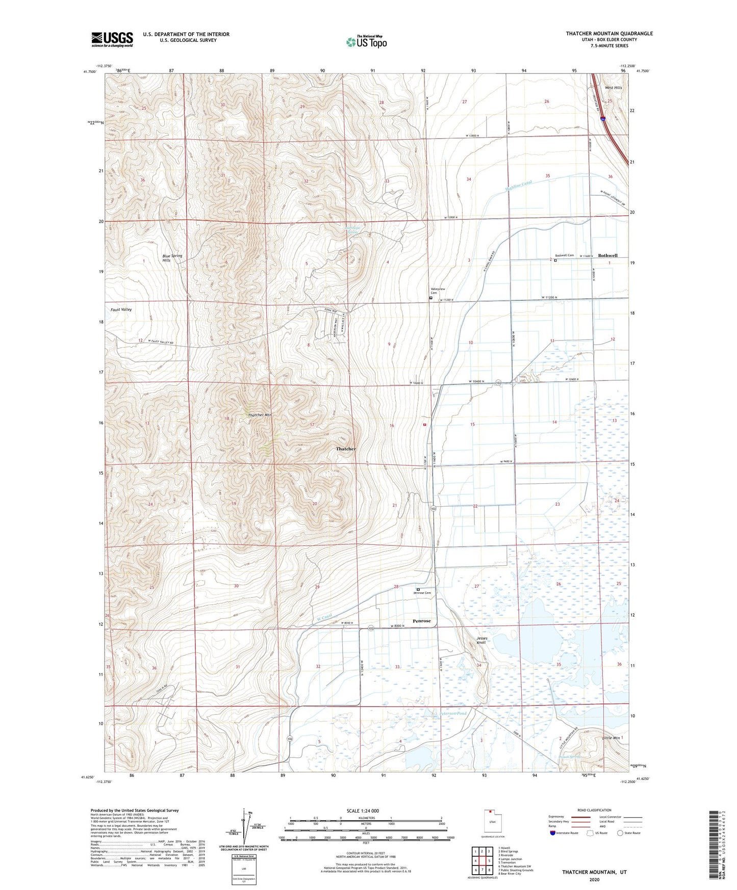
2023 topographic map quadrangle Thatcher Mountain in the state of Utah. Scale: 1:24000. Based on the newly updated USGS 7.5' US Topo map series, this map is in the following counties: Box Elder. The map contains contour data, water features, and other items you are used to seeing on USGS maps, but also has updated roads and other features. This is the next generation of topographic maps. Printed on high-quality waterproof paper with UV fade-resistant inks.
Quads adjacent to this one:
West: Lampo Junction
Northwest: Howell
North: Blind Springs
Northeast: Riverside
East: Tremonton
Southeast: Bear River City
South: Public Shooting Grounds
Southwest: Thatcher Mountain SW
This map covers the same area as the classic USGS quad with code o41112f3.
Contains the following named places: Blue Spring Hills, Bothwell, Bothwell Cemetery, Burnhope Spring, Faust Valley, Jesses Knoll, Penrose, Penrose Cemetery, Peterson Pond, Poison Spring, Salt Creek Waterfowl Management Area, Thatcher, Thatcher - Penrose Fire Department and Water Service District, Thatcher Census Designated Place, Thatcher Mountain, Valleyview Cemetery