MyTopo
Howell Utah US Topo Map
Couldn't load pickup availability
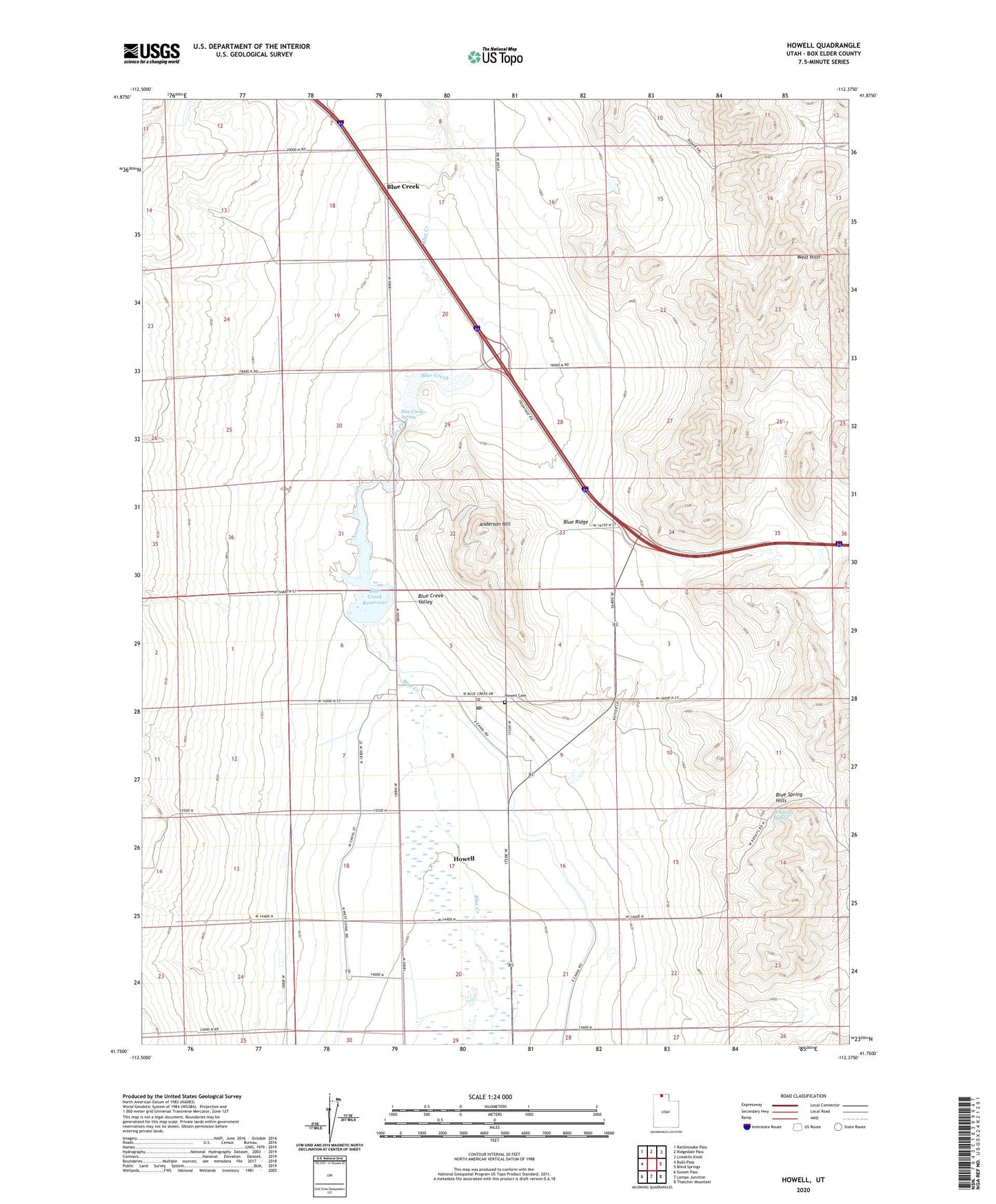
2023 topographic map quadrangle Howell in the state of Utah. Scale: 1:24000. Based on the newly updated USGS 7.5' US Topo map series, this map is in the following counties: Box Elder. The map contains contour data, water features, and other items you are used to seeing on USGS maps, but also has updated roads and other features. This is the next generation of topographic maps. Printed on high-quality waterproof paper with UV fade-resistant inks.
Quads adjacent to this one:
West: Bulls Pass
Northwest: Rattlesnake Pass
North: Ridgedale Pass
Northeast: Limekiln Knoll
East: Blind Springs
Southeast: Thatcher Mountain
South: Lampo Junction
Southwest: Sunset Pass
This map covers the same area as the classic USGS quad with code o41112g4.
Contains the following named places: Anderson Hill, Blue Creek, Blue Creek Reservoir, Blue Creek Spring, Blue Ridge, Dejarnatt Dam, Howell, Howell Airport, Howell Cemetery, Howell Post Office, Howell School, The Church of Jesus Christ of Latter Day Saints, Town of Howell, Wheatley Spring, ZIP Code: 84316