MyTopo
Lisbon Valley Utah US Topo Map
Couldn't load pickup availability
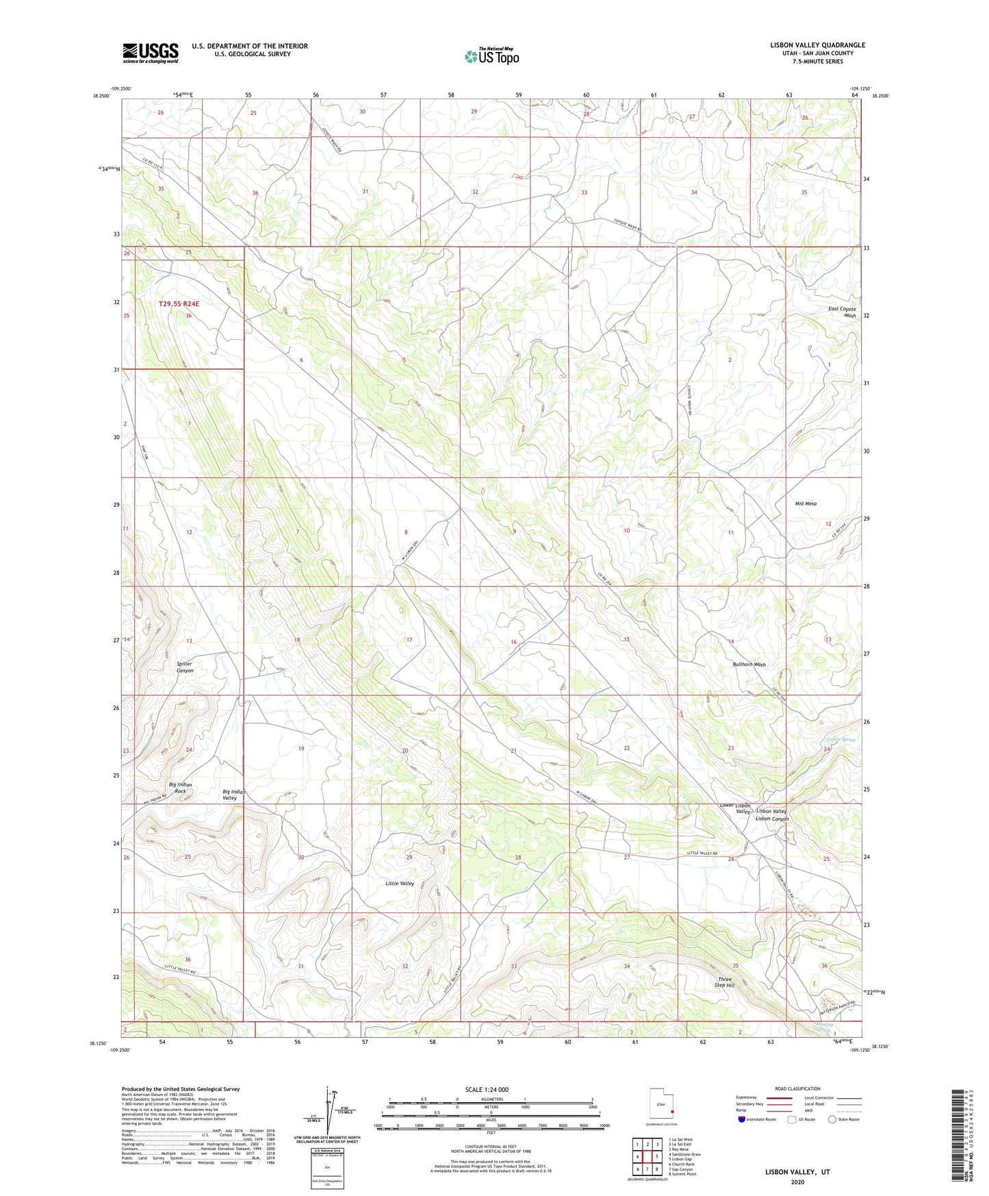
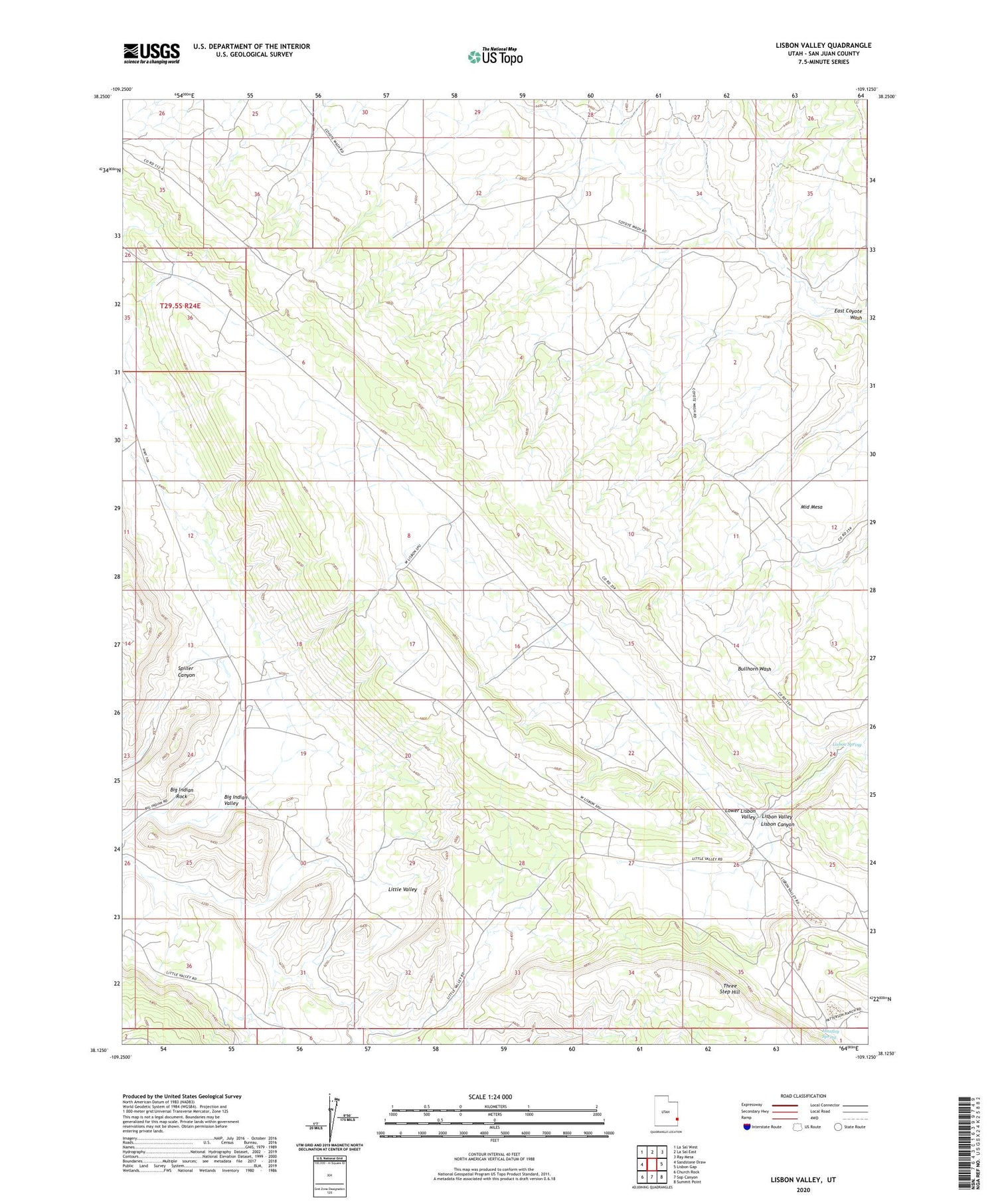
2020 topographic map quadrangle Lisbon Valley in the state of Utah. Scale: 1:24000. Based on the newly updated USGS 7.5' US Topo map series, this map is in the following counties: San Juan. The map contains contour data, water features, and other items you are used to seeing on USGS maps, but also has updated roads and other features. This is the next generation of topographic maps. Printed on high-quality waterproof paper with UV fade-resistant inks.
Quads adjacent to this one:
West: Sandstone Draw
Northwest: La Sal West
North: La Sal East
Northeast: Ray Mesa
East: Lisbon Gap
Southeast: Summit Point
South: Sop Canyon
Southwest: Church Rock
Contains the following named places: Big Indian Rock, Big Indian Valley, Cub Mine, Huntley Spring, Lisbon Spring, Lisbon Valley, Little Valley, Louise Mine, Middle Mesa, Three Step Hill