MyTopo
Summit Point Utah US Topo Map
Couldn't load pickup availability
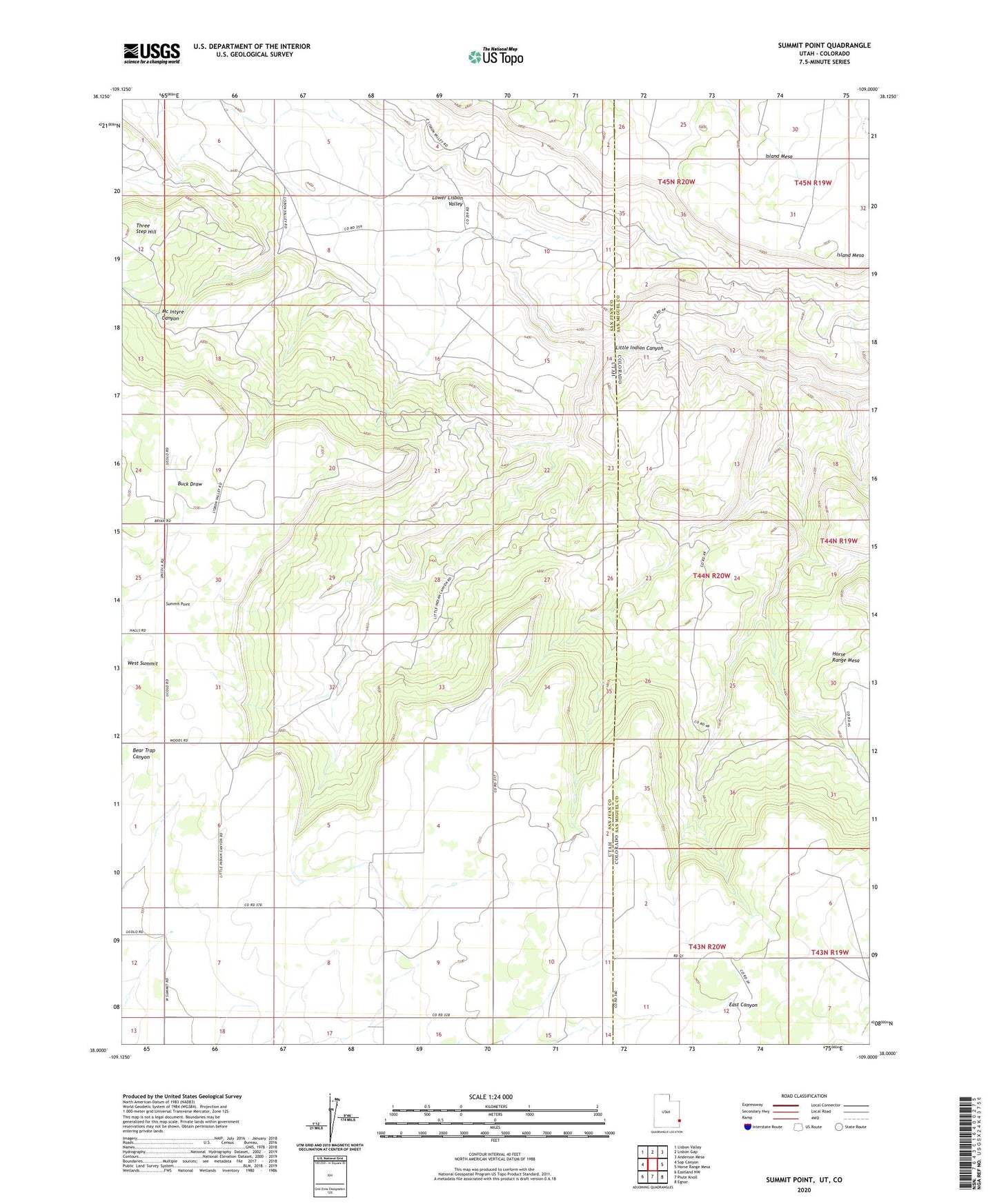
2023 topographic map quadrangle Summit Point in the states of Colorado, Utah. Scale: 1:24000. Based on the newly updated USGS 7.5' US Topo map series, this map is in the following counties: San Juan, San Miguel. The map contains contour data, water features, and other items you are used to seeing on USGS maps, but also has updated roads and other features. This is the next generation of topographic maps. Printed on high-quality waterproof paper with UV fade-resistant inks.
Quads adjacent to this one:
West: Sop Canyon
Northwest: Lisbon Valley
North: Lisbon Gap
Northeast: Anderson Mesa
East: Horse Range Mesa
Southeast: Egnar
South: Piute Knoll
Southwest: Eastland NW
This map covers the same area as the classic USGS quad with code o38109a1.
Contains the following named places: Ava Jay Mine, Big Buck One Mine, Bugwine Mine, Civet Cat Group Mine, Cone Mine, Cowhand Mine, Cuba Mine, Happy Jack Mine, Jackie Walls Mine, La Salle Mine, Little Indian Canyon, Lower Lisbon Valley, Roberta Lee Mine, Summit Point, Vanadium Queen Mine, West Summit School