MyTopo
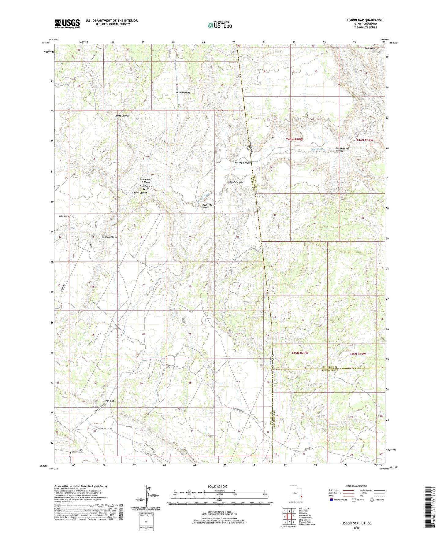
Lisbon Gap Utah US Topo Map
Couldn't load pickup availability
2023 topographic map quadrangle Lisbon Gap in the states of Colorado, Utah. Scale: 1:24000. Based on the newly updated USGS 7.5' US Topo map series, this map is in the following counties: San Juan, Montrose, San Miguel. The map contains contour data, water features, and other items you are used to seeing on USGS maps, but also has updated roads and other features. This is the next generation of topographic maps. Printed on high-quality waterproof paper with UV fade-resistant inks.
Quads adjacent to this one:
West: Lisbon Valley
Northwest: La Sal East
North: Ray Mesa
Northeast: Paradox
East: Anderson Mesa
Southeast: Horse Range Mesa
South: Summit Point
Southwest: Sop Canyon
This map covers the same area as the classic USGS quad with code o38109b1.
Contains the following named places: Ada Bell Mine, Bullhorn Wash, East Coyote Wash, Greasewood Canyon, Horsethief Canyon, Island Canyon, Lisbon Canyon, Lisbon Gap, Moosey Canyon, Moosey Point, Radar Mine, Snyder Water Canyon, Spring Canyon, White Cow Mine