MyTopo
Loa Utah US Topo Map
Couldn't load pickup availability
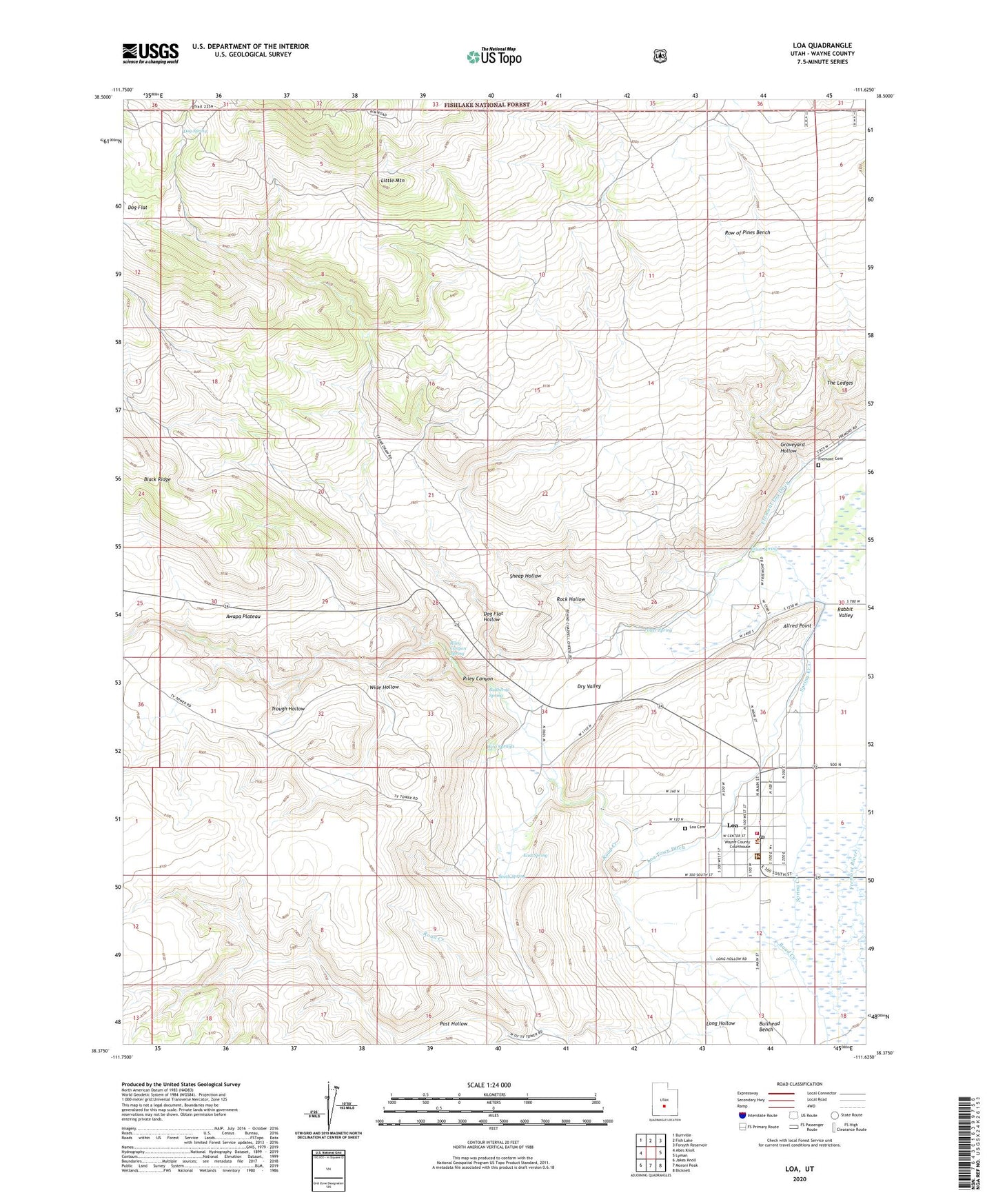
2020 topographic map quadrangle Loa in the state of Utah. Scale: 1:24000. Based on the newly updated USGS 7.5' US Topo map series, this map is in the following counties: Wayne. The map contains contour data, water features, and other items you are used to seeing on USGS maps, but also has updated roads and other features. This is the next generation of topographic maps. Printed on high-quality waterproof paper with UV fade-resistant inks.
Quads adjacent to this one:
West: Abes Knoll
Northwest: Burrville
North: Fish Lake
Northeast: Forsyth Reservoir
East: Lyman
Southeast: Bicknell
South: Moroni Peak
Southwest: Jakes Knoll
Contains the following named places: Allred Point, Black Ridge, Brian Spring, Bullberry Spring, Dog Flat Hollow, Dog Spring, Dry Valley, East Spring, Fremont Cemetery, Fremont Loa Ditch, Fremont River Ranger Station Loa Office, Graveyard Hollow, Little Mountain, Loa, Loa Cemetery, Loa District Ranger Station, Loa Fire Department, Loa Fish Hatchery, Loa Post Office, Loa School, Loa Town Ditch, Long Hollow, Post Hollow, Potter Spring, Riley Canyon, Riley Canyon Spring, Road Creek, Rock Hollow, Row of Pines Bench, Sheep Hollow, South Spring, The Church of Jesus Christ of Latter Day Saints, Town of Loa, Trough Hollow, Wayne County Sheriffs Office, West Springs, Wide Hollow, ZIP Code: 84747