MyTopo
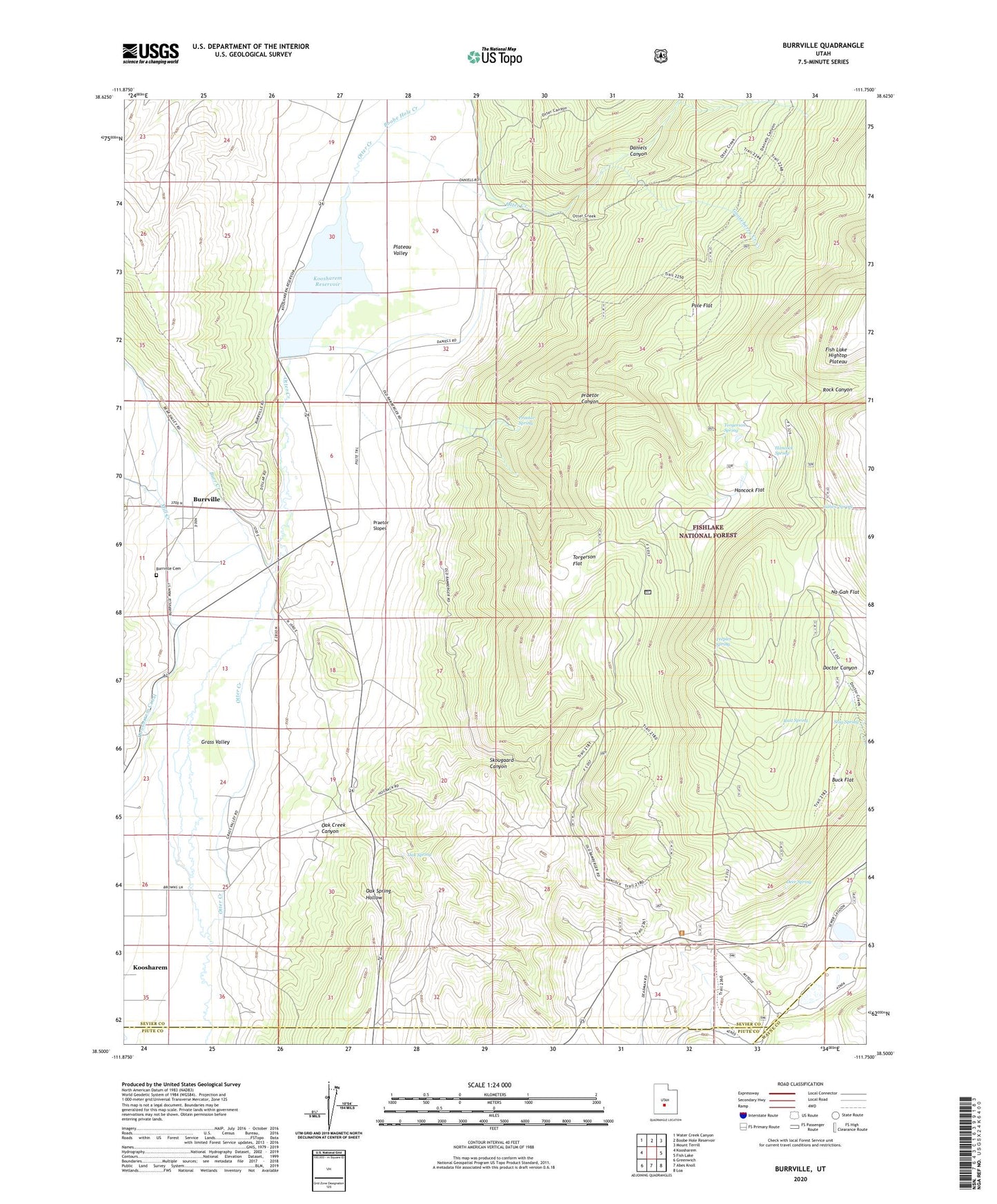
Burrville Utah US Topo Map
Couldn't load pickup availability
Also explore the Burrville Forest Service Topo of this same quad for updated USFS data
2023 topographic map quadrangle Burrville in the state of Utah. Scale: 1:24000. Based on the newly updated USGS 7.5' US Topo map series, this map is in the following counties: Sevier, Piute, Wayne. The map contains contour data, water features, and other items you are used to seeing on USGS maps, but also has updated roads and other features. This is the next generation of topographic maps. Printed on high-quality waterproof paper with UV fade-resistant inks.
Quads adjacent to this one:
West: Koosharem
Northwest: Water Creek Canyon
North: Boobe Hole Reservoir
Northeast: Mount Terrill
East: Fish Lake
Southeast: Loa
South: Abes Knoll
Southwest: Greenwich
This map covers the same area as the classic USGS quad with code o38111e7.
Contains the following named places: Boobe Hole Creek, Buck Flat, Burr Creek, Burrville, Burrville Cemetery, Daniels Canyon, Deer Spring, Gahew Spring, Gooseberry Creek, Hancock Flat, Hancock Spring, Koosharem Dam, Koosharem Reservoir, Koosharem Reservoir Recreation Site, Mill Creek, Na-Gah Flat, Oak Creek Canyon, Oak Spring, Oak Spring Hollow, Plateau Valley, Pole Flat, Praetor Canyon, Praetor Slopes, Praetor Spring, Rock Canyon, Rust Spring, Skougaard Canyon, Stag Spring, Teeples Spring, Torgerson Flat, Torgerson Spring