MyTopo
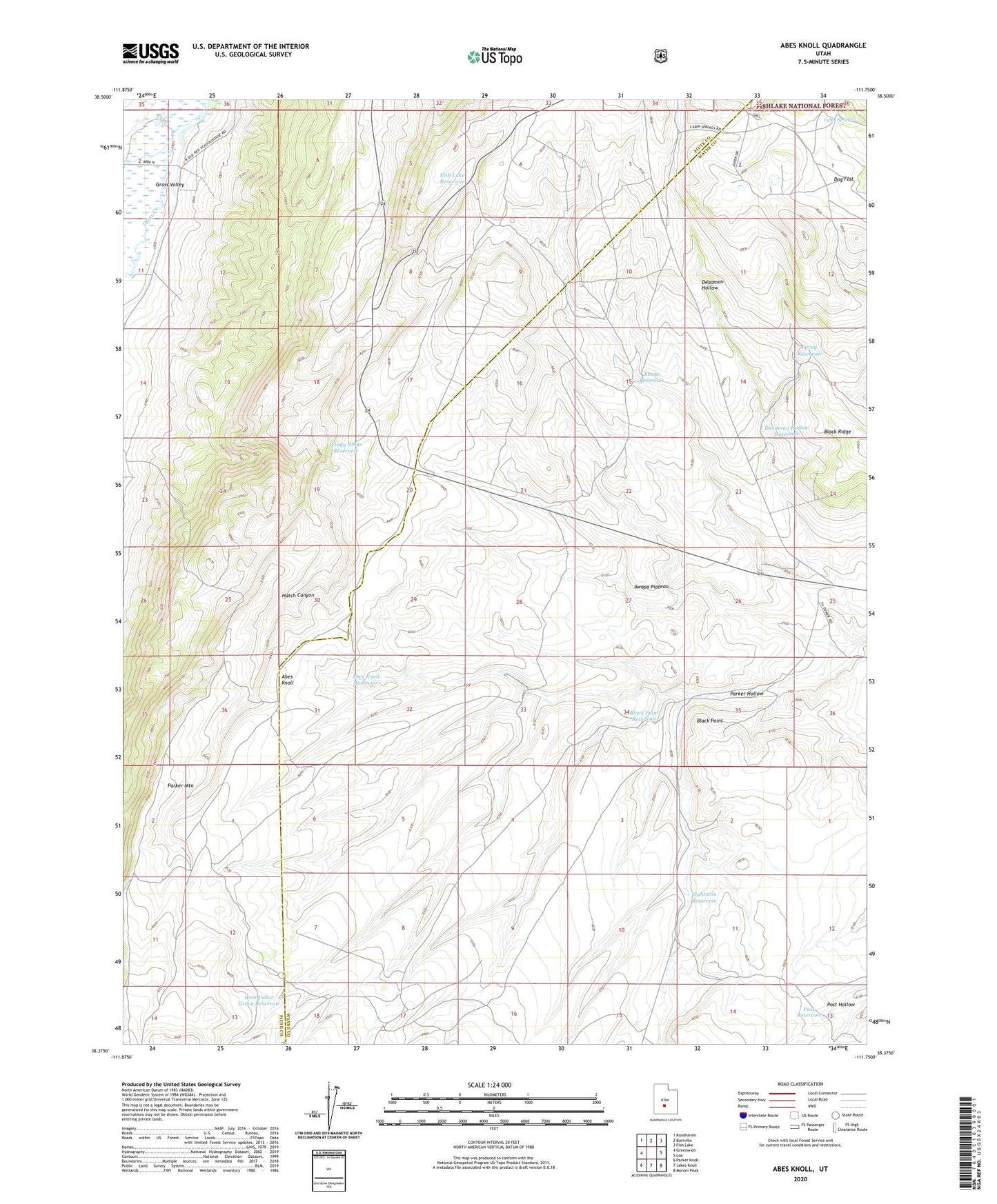
Abes Knoll Utah US Topo Map
Couldn't load pickup availability
Also explore the Abes Knoll Forest Service Topo of this same quad for updated USFS data
2023 topographic map quadrangle Abes Knoll in the state of Utah. Scale: 1:24000. Based on the newly updated USGS 7.5' US Topo map series, this map is in the following counties: Wayne, Piute. The map contains contour data, water features, and other items you are used to seeing on USGS maps, but also has updated roads and other features. This is the next generation of topographic maps. Printed on high-quality waterproof paper with UV fade-resistant inks.
Quads adjacent to this one:
West: Greenwich
Northwest: Koosharem
North: Burrville
Northeast: Fish Lake
East: Loa
Southeast: Moroni Peak
South: Jakes Knoll
Southwest: Parker Knoll
This map covers the same area as the classic USGS quad with code o38111d7.
Contains the following named places: Abes Knoll, Abes Knoll Reservoir, Black Point, Black Point Reservoir, Cabin Spring, Cedar Grove, Deadman Hollow, Deadman Hollow Reservoir, Dog Flat, Eightmile Reservoir, Evans Reservoir, Fish Lake Reservoir, Hatch Canyon, Parker Hollow, Pass Reservoir, Spray Reservoir, West Cedar Grove Reservoir, Windy Ridge Reservoir