
MyTopo
Marysvale Peak Utah US Topo Map
Couldn't load pickup availability
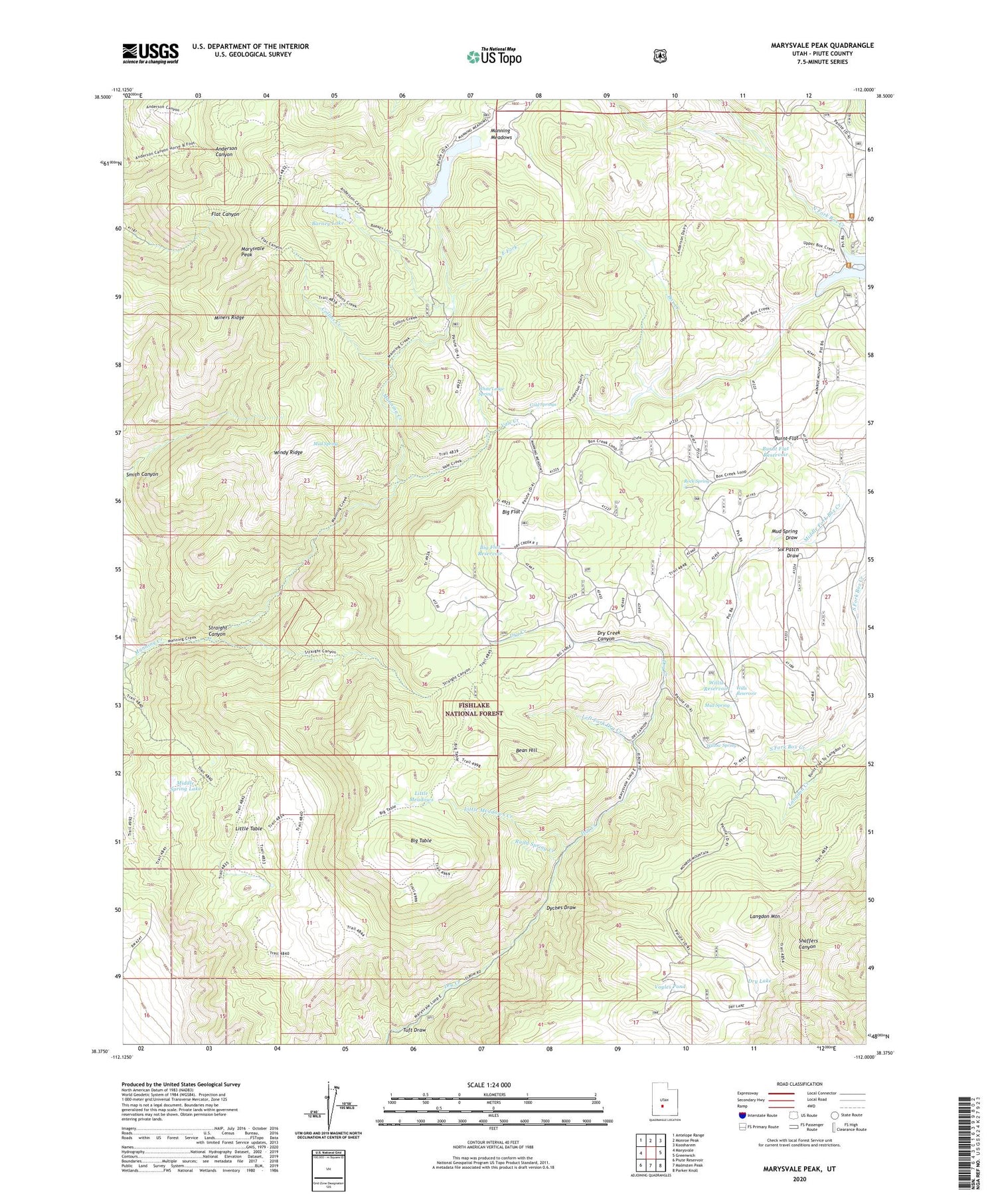
2020 topographic map quadrangle Marysvale Peak in the state of Utah. Scale: 1:24000. Based on the newly updated USGS 7.5' US Topo map series, this map is in the following counties: Piute. The map contains contour data, water features, and other items you are used to seeing on USGS maps, but also has updated roads and other features. This is the next generation of topographic maps. Printed on high-quality waterproof paper with UV fade-resistant inks.
Quads adjacent to this one:
West: Marysvale
Northwest: Antelope Range
North: Monroe Peak
Northeast: Koosharem
East: Greenwich
Southeast: Parker Knoll
South: Malmsten Peak
Southwest: Piute Reservoir
Contains the following named places: Barney Lake, Barney Lake Reservoir Dam, Bean Hill, Big Flat, Big Flat Reservoir, Big Table, Blackbird Mine, Burnt Flat, Burnt Flat Reservoir, Cold Springs, Dry Creek Guard Station, Dry Lake, Dyches Draw, East Fork, Langdon Creek, Langdon Mountain, Left Fork Dry Creek, Little Meadows, Little Meadows Creek, Little Table, Manning Meadows, Manning Meadows Dam, Manning Meadows Reservoir, Marysvale Peak, Middle Spring Lake, Miners Ridge, Mud Spring, Mud Spring Draw, North Fork Box Creek, Ogden Cabin, Rock Spring, Rudd Spring Creek, Six Patch Draw, Smith Canyon, Smith Canyon Trail, Straight Canyon, Tuft Draw, Upper Box Creek Dam, Upper Box Creek Reservoir, Vale Creek, Voyles Pond, White Ledge Spring, Willis Reservoir, Willow Spring, Wills Reservoir, Windy Ridge


