MyTopo
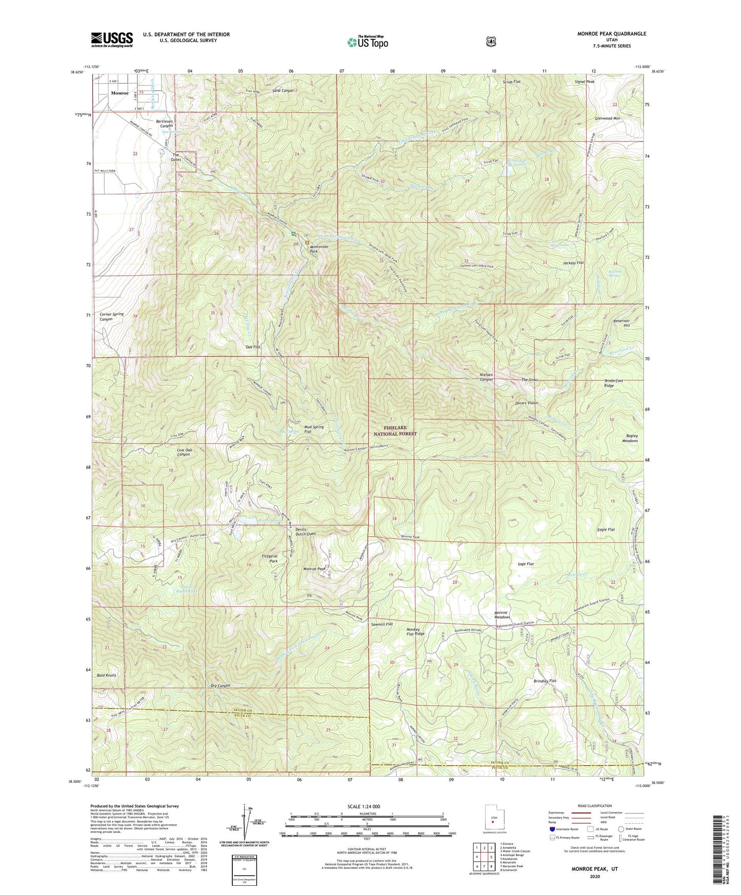
Monroe Peak Utah US Topo Map
Couldn't load pickup availability
Also explore the Monroe Peak Forest Service Topo of this same quad for updated USFS data
2023 topographic map quadrangle Monroe Peak in the state of Utah. Scale: 1:24000. Based on the newly updated USGS 7.5' US Topo map series, this map is in the following counties: Sevier, Piute. The map contains contour data, water features, and other items you are used to seeing on USGS maps, but also has updated roads and other features. This is the next generation of topographic maps. Printed on high-quality waterproof paper with UV fade-resistant inks.
Quads adjacent to this one:
West: Antelope Range
Northwest: Elsinore
North: Annabella
Northeast: Water Creek Canyon
East: Koosharem
Southeast: Greenwich
South: Marysvale Peak
Southwest: Marysvale
This map covers the same area as the classic USGS quad with code o38112e1.
Contains the following named places: Bagley Meadows, Bertlesen Canyon, Bertlesen Ditch, Brindley Flat, City of Monroe, Corner Spring Canyon, Devils Dutch Oven, Doxford Creek, Eagle Flat, First Lefthand Fork, Fitzgeral Park, Hot Springs, Hunts Lakes, Jackass Creek, Jackass Flat, Koosharem Guard Station Scrub Flat Trail, Lower Hunts Lake, Monkey Flat Ridge, Monkey Fork Dry Canyon, Monroe Creek, Monroe Meadows, Monroe Peak, Monrovian Park, Monrovian Park Campground, Mud Lake, Mud Spring, Mud Spring Flat, Nielsen Canyon, Oak Flat, Oak Flat Creek, Oscars Vision, Reservoir Creek, Sage Flat, Sawmill Flat, Sawmill Spring, Scrub Flat, Scrub Flat Reservoir, Second Lefthand Fork, Second Lefthand Fork Trail, Serviceberry Creek, Serviceberry Trail, Sevier County Ambulance - Monore, Shingle Creek, South Bend Canal, South Fork Monroe Creek, The Gates, The Sinks, Third Lefthand Fork, Third Lefthand Fork Trail, Washburn Reservoir, ZIP Code: 84754