MyTopo
Piute Reservoir Utah US Topo Map
Couldn't load pickup availability
Also explore the Piute Reservoir Forest Service Topo of this same quad for updated USFS data
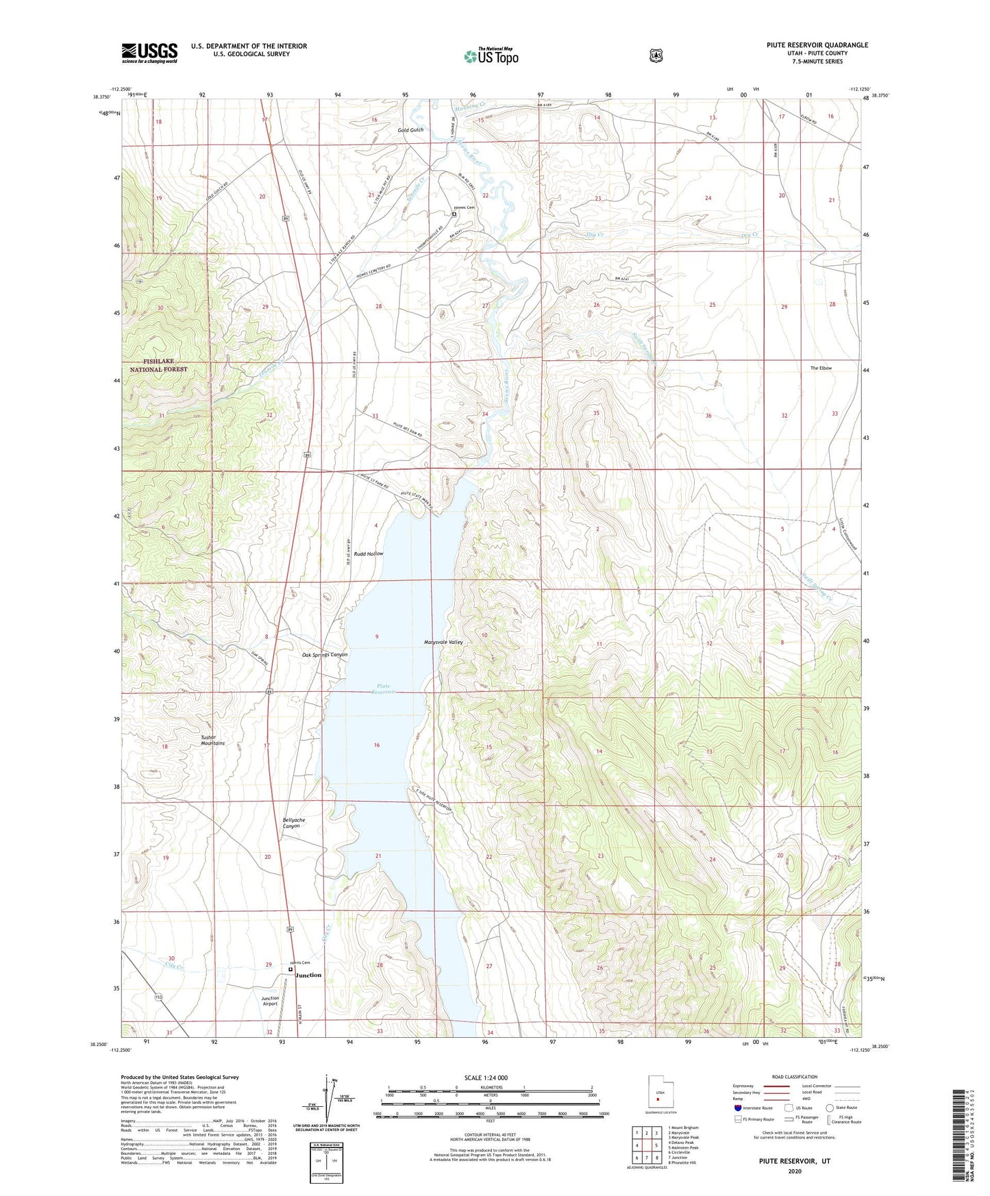
2023 topographic map quadrangle Piute Reservoir in the state of Utah. Scale: 1:24000. Based on the newly updated USGS 7.5' US Topo map series, this map is in the following counties: Piute. The map contains contour data, water features, and other items you are used to seeing on USGS maps, but also has updated roads and other features. This is the next generation of topographic maps. Printed on high-quality waterproof paper with UV fade-resistant inks.
Quads adjacent to this one:
West: Delano Peak
Northwest: Mount Brigham
North: Marysvale
Northeast: Marysvale Peak
East: Malmsten Peak
Southeast: Phonolite Hill
South: Junction
Southwest: Circleville
This map covers the same area as the classic USGS quad with code o38112c2.
Contains the following named places: Bellyache Canyon, City Creek, Dry Creek, Dry Lake, Gold Gulch, Harris Cemetery, Howes Cemetery, Junction Airport, Oak Springs Canyon, Piute Campground, Piute County, Piute Dam, Piute Lake State Park, Piute Reservoir, Rudd Hollow, Swift Spring Creek, Tenmile Creek, The Elbow