MyTopo
Mexican Hat Utah US Topo Map
Couldn't load pickup availability
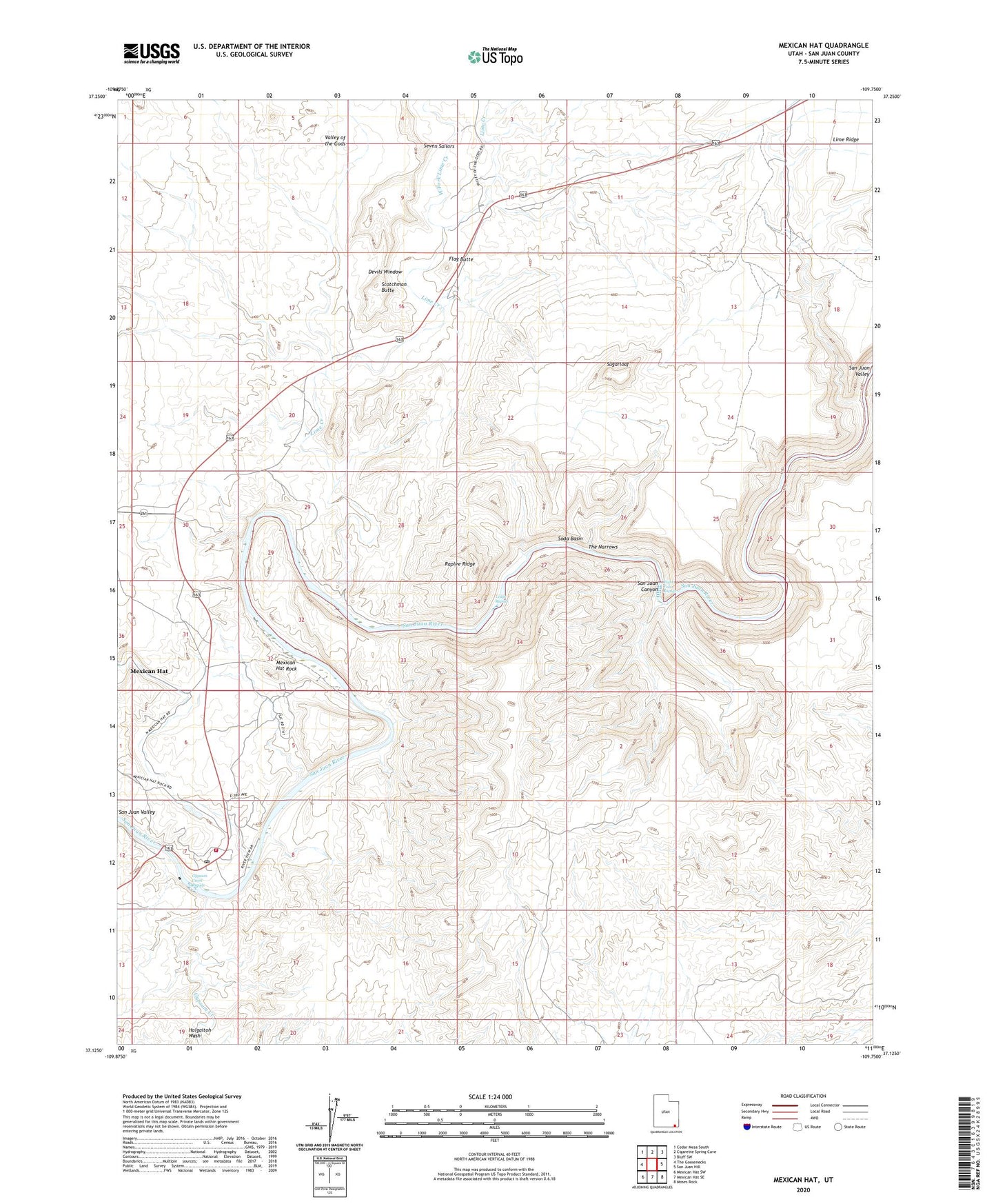
2023 topographic map quadrangle Mexican Hat in the state of Utah. Scale: 1:24000. Based on the newly updated USGS 7.5' US Topo map series, this map is in the following counties: San Juan. The map contains contour data, water features, and other items you are used to seeing on USGS maps, but also has updated roads and other features. This is the next generation of topographic maps. Printed on high-quality waterproof paper with UV fade-resistant inks.
Quads adjacent to this one:
West: The Goosenecks
Northwest: Cedar Mesa South
North: Cigarette Spring Cave
Northeast: Bluff SW
East: San Juan Hill
Southeast: Moses Rock
South: Mexican Hat SE
Southwest: Mexican Hat SW
This map covers the same area as the classic USGS quad with code o37109b7.
Contains the following named places: Devils Window, Eight Foot Rapids, Flag Butte, Goodridge Rocks, Gypsum Creek, Gypsum Creek Rapids, Halgaitoh Wash, Ledge Rapids, Lime Creek, Mexican Hat, Mexican Hat Census Designated Place, Mexican Hat Post Office, Mexican Hat Rock, Raplee Ridge, San Juan Canyon, San Juan Fire Department - Mexican Hat Station, Scotchman Butte, Seven Sailors, Soda Basin, Soda Spring, Sugarloaf, The Narrows, Valles Trailer Park, West Fork Lime Creek