MyTopo
Miners Cabin Wash Utah US Topo Map
Couldn't load pickup availability
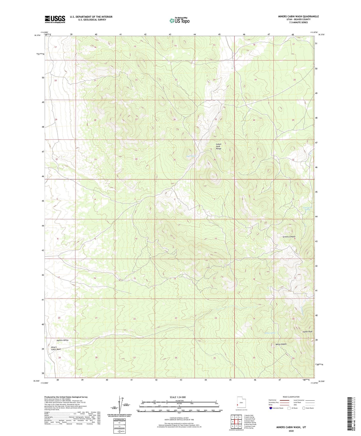
2020 topographic map quadrangle Miners Cabin Wash in the state of Utah. Scale: 1:24000. Based on the newly updated USGS 7.5' US Topo map series, this map is in the following counties: Beaver. The map contains contour data, water features, and other items you are used to seeing on USGS maps, but also has updated roads and other features. This is the next generation of topographic maps. Printed on high-quality waterproof paper with UV fade-resistant inks.
Quads adjacent to this one:
West: Gleason Basin
Northwest: Hamlin Well
North: Lopers Spring
Northeast: Sawtooth Peak
East: Buckhorn Spring
Southeast: Pinto Spring
South: Atchison Creek
Southwest: White Rock Peak
Contains the following named places: Blue Jay Mine, Chokecherry Spring, Indian Peak, Mackleprang Homestead, Marys Nipple, Miners Cabin Wash, Ryan Spring, Willow Spring