MyTopo
White Rock Peak Nevada US Topo Map
Couldn't load pickup availability
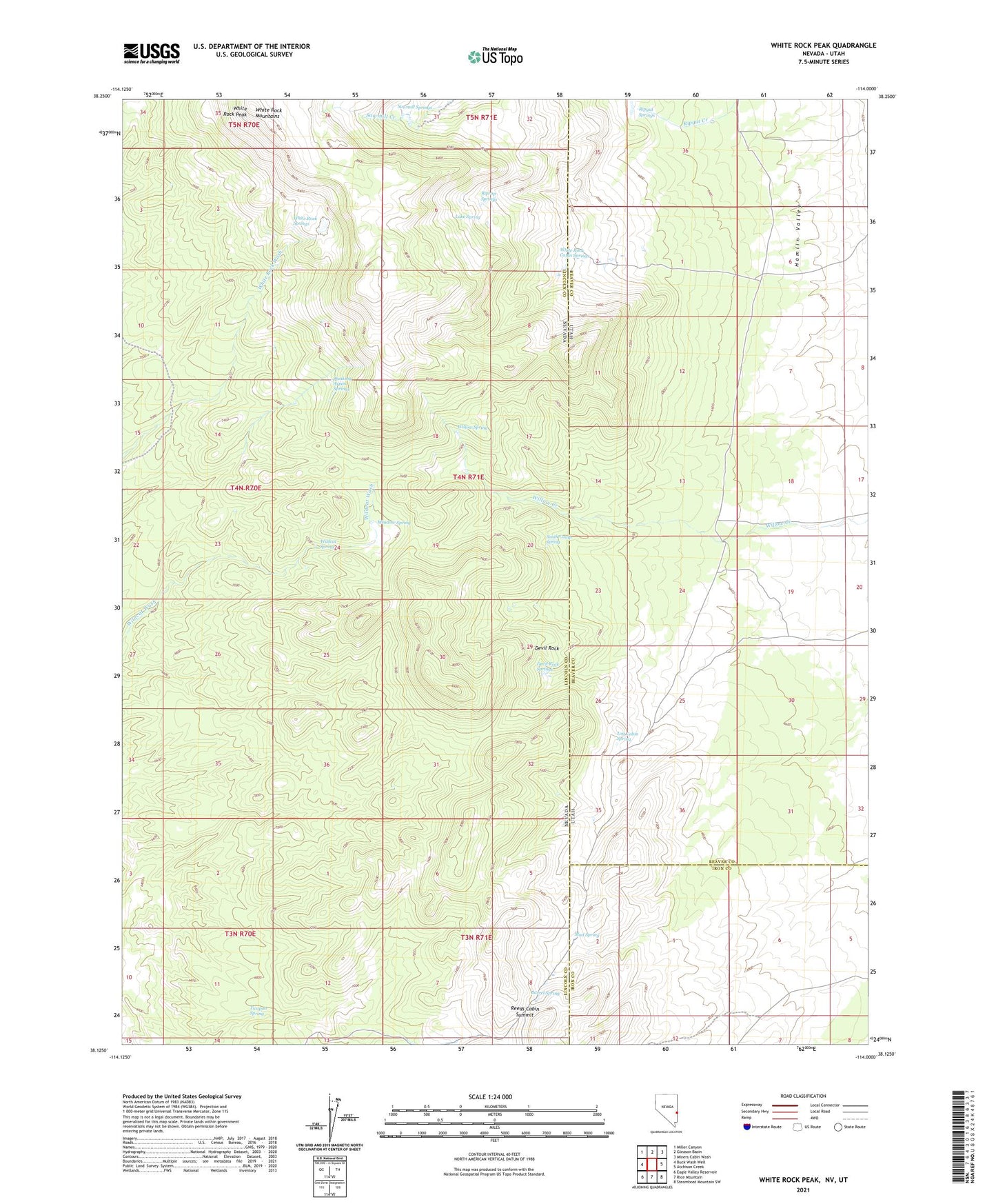
2021 topographic map quadrangle White Rock Peak in the states of Nevada, Utah. Scale: 1:24000. Based on the newly updated USGS 7.5' US Topo map series, this map is in the following counties: Lincoln, Beaver, Iron. The map contains contour data, water features, and other items you are used to seeing on USGS maps, but also has updated roads and other features. This is the next generation of topographic maps. Printed on high-quality waterproof paper with UV fade-resistant inks.
Quads adjacent to this one:
West: Buck Wash Well
Northwest: Miller Canyon
North: Gleason Basin
Northeast: Miners Cabin Wash
East: Atchison Creek
Southeast: Steamboat Mountain SW
South: Rice Mountain
Southwest: Eagle Valley Reservoir
Contains the following named places: Barrel Spring, Devil Rock, Devil Rock Springs, Lake Spring, Log Cabin Spring, Meadow Spring, Mud Spring, Quaking Aspen Springs, Reeds Cabin, Reeds Cabin Summit, Ripgut Springs, Riprap Springs, Sawmill Springs, Scottys Cabin, South Camp Spring, Ticapoo Spring, White Rock Cabin Springs, White Rock Mountains, White Rock Peak, White Rock Range Wilderness, White Rock Springs, Wildcat Spring, Willow Spring