MyTopo
Moroni Peak Utah US Topo Map
Couldn't load pickup availability
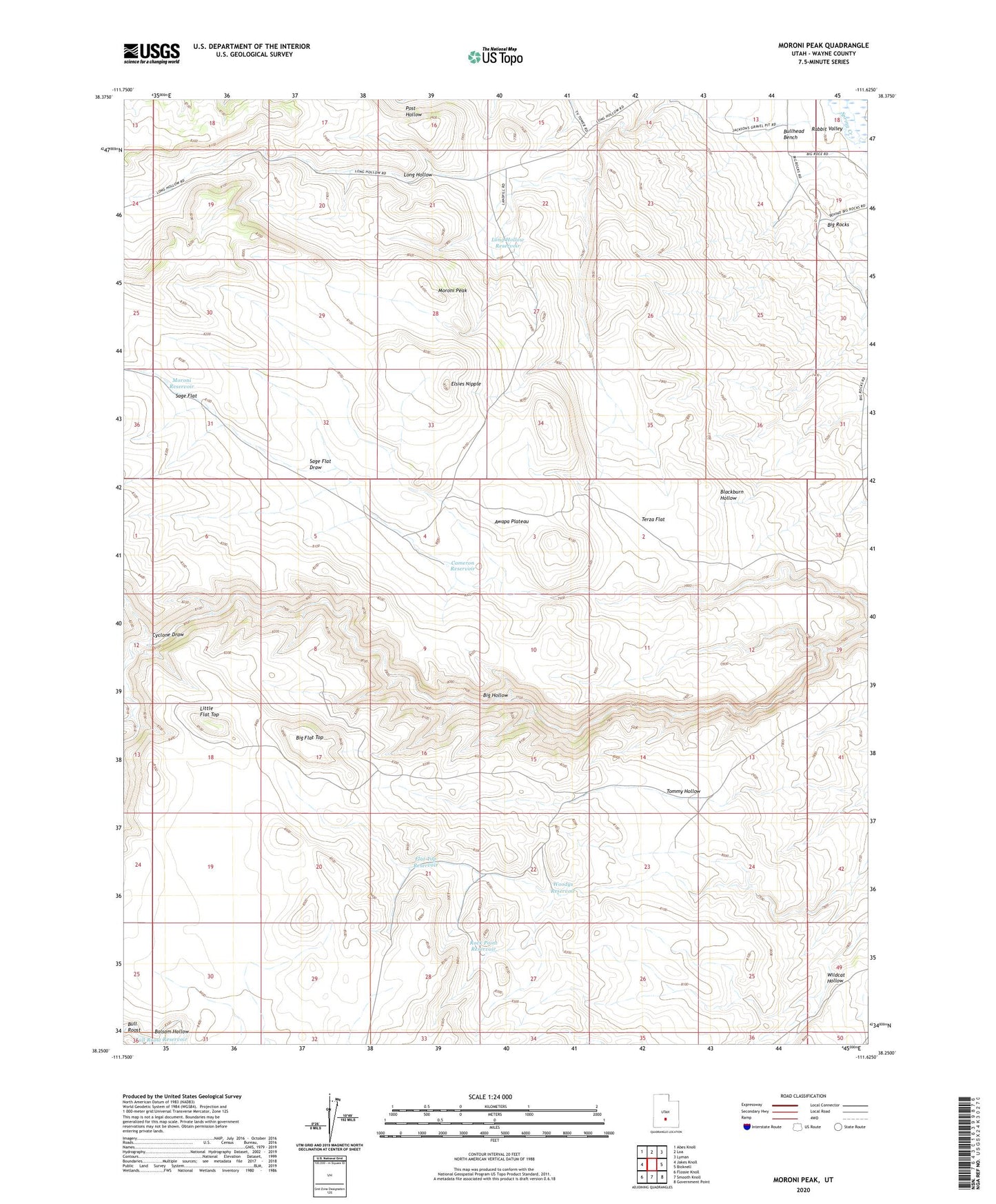
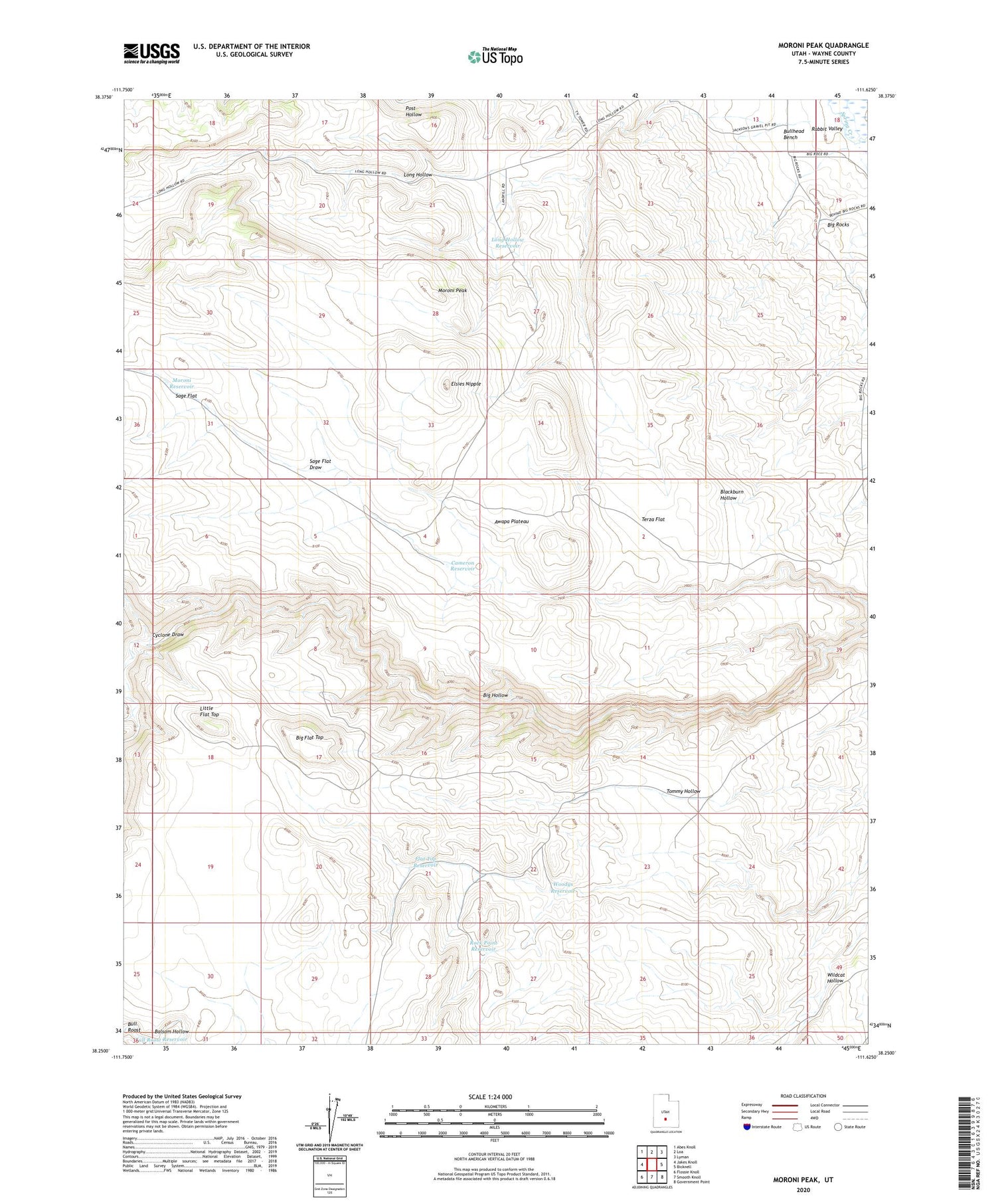
2020 topographic map quadrangle Moroni Peak in the state of Utah. Scale: 1:24000. Based on the newly updated USGS 7.5' US Topo map series, this map is in the following counties: Wayne. The map contains contour data, water features, and other items you are used to seeing on USGS maps, but also has updated roads and other features. This is the next generation of topographic maps. Printed on high-quality waterproof paper with UV fade-resistant inks.
Quads adjacent to this one:
West: Jakes Knoll
Northwest: Abes Knoll
North: Loa
Northeast: Lyman
East: Bicknell
Southeast: Government Point
South: Smooth Knoll
Southwest: Flossie Knoll
Contains the following named places: Big Flat Top, Big Rocks, Bull Roost Reservoir, Bullhead Bench, Cameron Reservoir, Cyclone Draw, Elsies Nipple, Flat Top Reservoir, Little Flat Top, Long Hollow Reservoir, Moroni Peak, Moroni Reservoir, Rock Point Reservoir, Sage Flat, Terza Flat, Woodys Reservoir