
MyTopo
Mount Brigham Utah US Topo Map
Couldn't load pickup availability
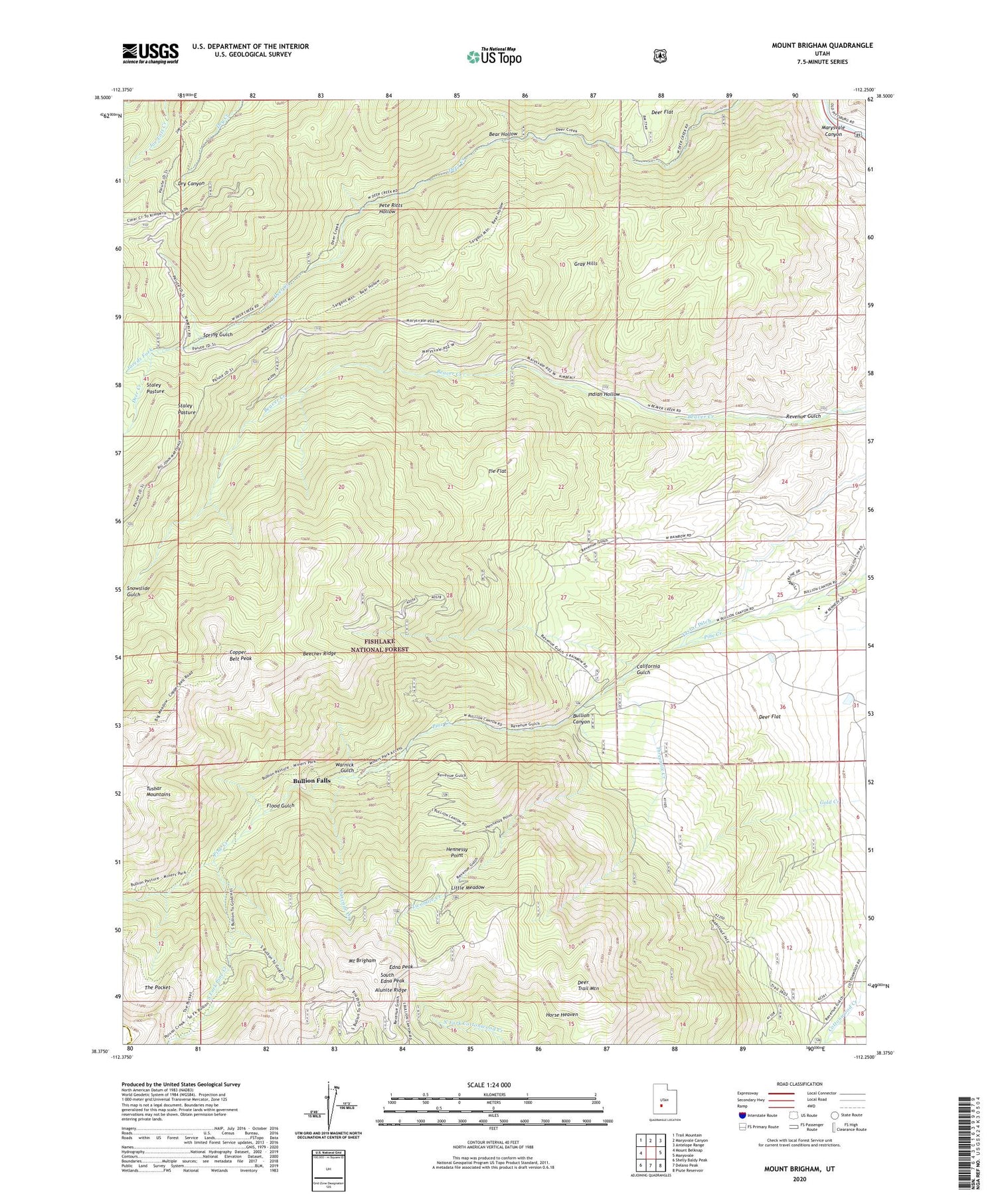
2020 topographic map quadrangle Mount Brigham in the state of Utah. Scale: 1:24000. Based on the newly updated USGS 7.5' US Topo map series, this map is in the following counties: Piute, Beaver. The map contains contour data, water features, and other items you are used to seeing on USGS maps, but also has updated roads and other features. This is the next generation of topographic maps. Printed on high-quality waterproof paper with UV fade-resistant inks.
Quads adjacent to this one:
West: Mount Belknap
Northwest: Trail Mountain
North: Marysvale Canyon
Northeast: Antelope Range
East: Marysvale
Southeast: Piute Reservoir
South: Delano Peak
Southwest: Shelly Baldy Peak
Contains the following named places: Alunite Ridge, Bear Hollow, Beaver Creek Recreation Site, Beecher Ridge, Bullion Canyon, Bullion Falls, Bullion Trail, Butler Beck Cabin, California Gulch, Cascade Creek, Copper Belt Peak, Copper Belt Trail, Deer Creek Guard Station, Deer Creek Trail, Deer Flat, Deer Trail Mine, Deer Trail Mountain, Edna Peak, Flood Gulch, Gray Hills, Hennessy Point, Horse Heaven, Indian Hollow, Jareds Fork, Little Meadow, Mount Brigham, Pete Ritts Hollow, Rainbow Mine, Revenue Gulch, Silver King Mine, Snowslide Gulch, South Edna Peak, South Fork Pine Creek, Spring Gulch, Staley Pasture, Taylor Ditch, The Pocket, Threemile Creek, Tie Flat, Town of Marysvale, Twomile Creek, Warnick Gulch


