MyTopo
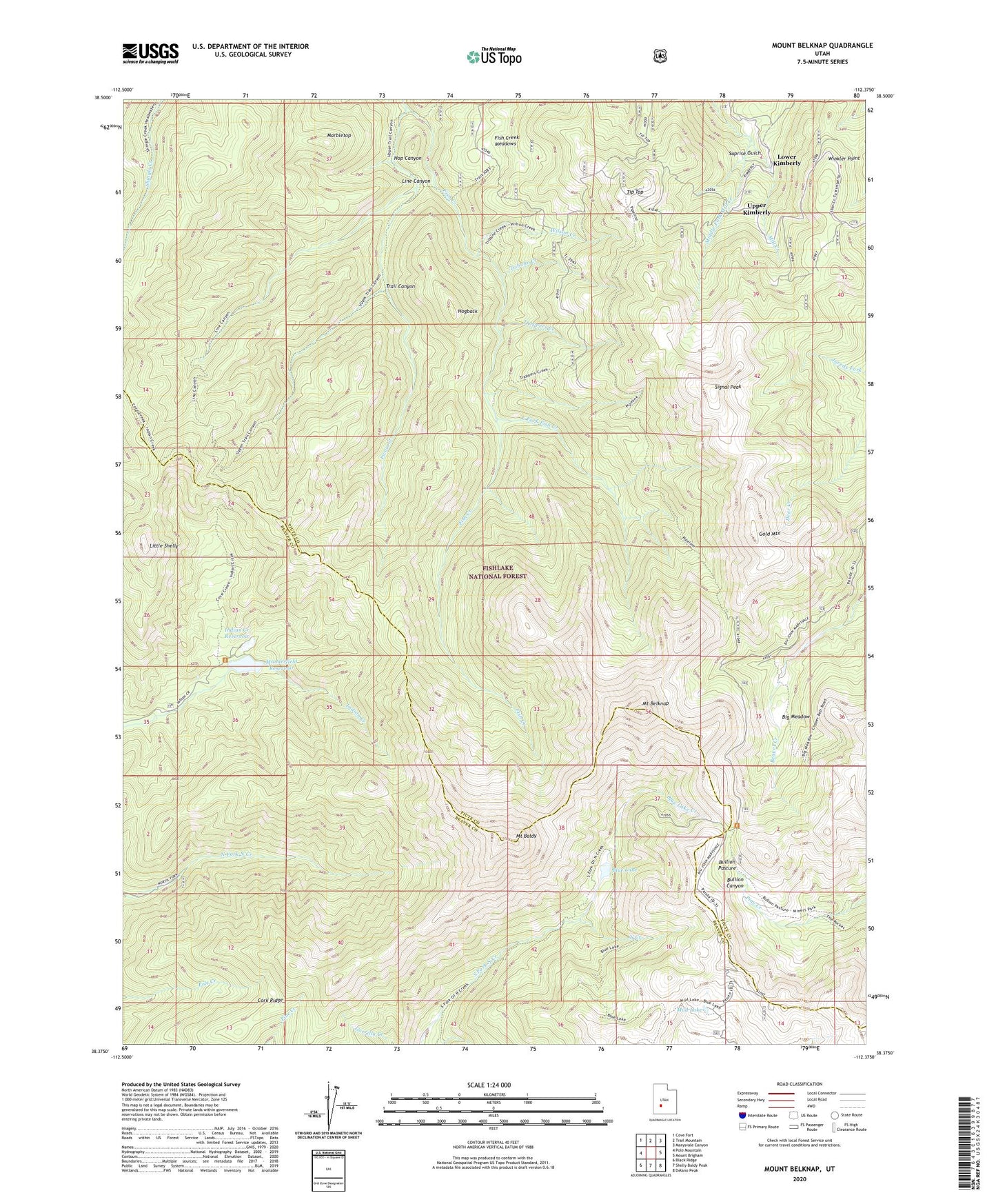
Mount Belknap Utah US Topo Map
Couldn't load pickup availability
Also explore the Mount Belknap Forest Service Topo of this same quad for updated USFS data
2023 topographic map quadrangle Mount Belknap in the state of Utah. Scale: 1:24000. Based on the newly updated USGS 7.5' US Topo map series, this map is in the following counties: Piute, Beaver. The map contains contour data, water features, and other items you are used to seeing on USGS maps, but also has updated roads and other features. This is the next generation of topographic maps. Printed on high-quality waterproof paper with UV fade-resistant inks.
Quads adjacent to this one:
West: Pole Mountain
Northwest: Cove Fort
North: Trail Mountain
Northeast: Marysvale Canyon
East: Mount Brigham
Southeast: Delano Peak
South: Shelly Baldy Peak
Southwest: Black Ridge
This map covers the same area as the classic USGS quad with code o38112d4.
Contains the following named places: Big Meadow, Blue Lake, Blue Lake Creek, Blue Lake Dam, Bullion Pasture, Cork Ridge, East Fork Fish Creek, Fish Creek Meadows, Fishlake National Forest, Gold Mountain, Grasshopper Mine, Hogback, Hop Canyon, Indian Creek Dam, Indian Creek Reservoir, Line Canyon, Little Shelly, Lower Kimberly, Lower Kimberly Mine, Manderfield Dam, Manderfield Reservoir, Marbletop, Middle Fork Mill Creek, Mount Baldy, Mount Belknap, Mud Lake, Picnic Creek, Pipeline Trail, Sevier Mine, Signal Peak, Suprise Gulch, Tip Top, Trail Canyon, Trappers Creek, Tribune Creek, Tushar Trail, Upper Kimbaberly Mine, Upper Kimberly, Whiterock Hump, Wilson Creek, Winkler Point