MyTopo
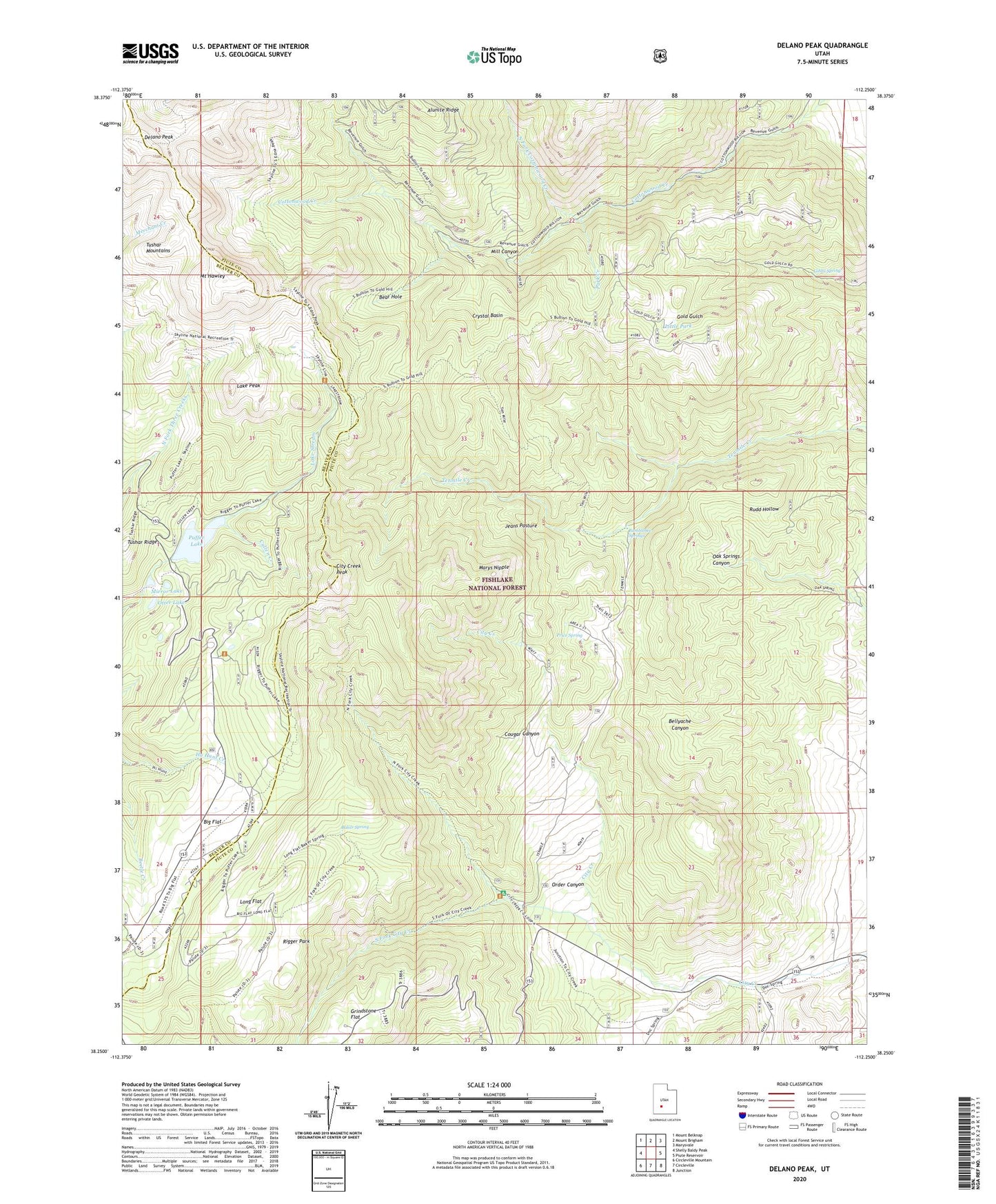
Delano Peak Utah US Topo Map
Couldn't load pickup availability
Also explore the Delano Peak Forest Service Topo of this same quad for updated USFS data
2023 topographic map quadrangle Delano Peak in the state of Utah. Scale: 1:24000. Based on the newly updated USGS 7.5' US Topo map series, this map is in the following counties: Piute, Beaver. The map contains contour data, water features, and other items you are used to seeing on USGS maps, but also has updated roads and other features. This is the next generation of topographic maps. Printed on high-quality waterproof paper with UV fade-resistant inks.
Quads adjacent to this one:
West: Shelly Baldy Peak
Northwest: Mount Belknap
North: Mount Brigham
Northeast: Marysvale
East: Piute Reservoir
Southeast: Junction
South: Circleville
Southwest: Circleville Mountain
This map covers the same area as the classic USGS quad with code o38112c3.
Contains the following named places: Baker Spring, Bay Cabin, Bear Hole, Big Flat, Big Flat Guard Station, Blainies Dam, Bumblebee Springs, City Creek Campground, City Creek Park, City Creek Peak, Cougar Canyon, Crystal Basin, Cullen Creek, Delano Peak, Elk Meadows Ski Area, Gibbs Spring, Grindstone Flat, Jeans Pasture, Lake Peak, Little Park, Long Flat, Marys Nipple, Mill Canyon, Mirror Lake, Mount Hawley, North Fork Cottonwood Creek, Order Canyon, Otter Lake, Park Creek, Price Spring, Puffer Lake, Puffer Lake Dam, Rigger Park, Skyline National Recreation Trail, South Fork City Creek, Telluride Cabin, Tushar Ridge, ZIP Code: 84740