MyTopo
Mount Catherine Utah US Topo Map
Couldn't load pickup availability
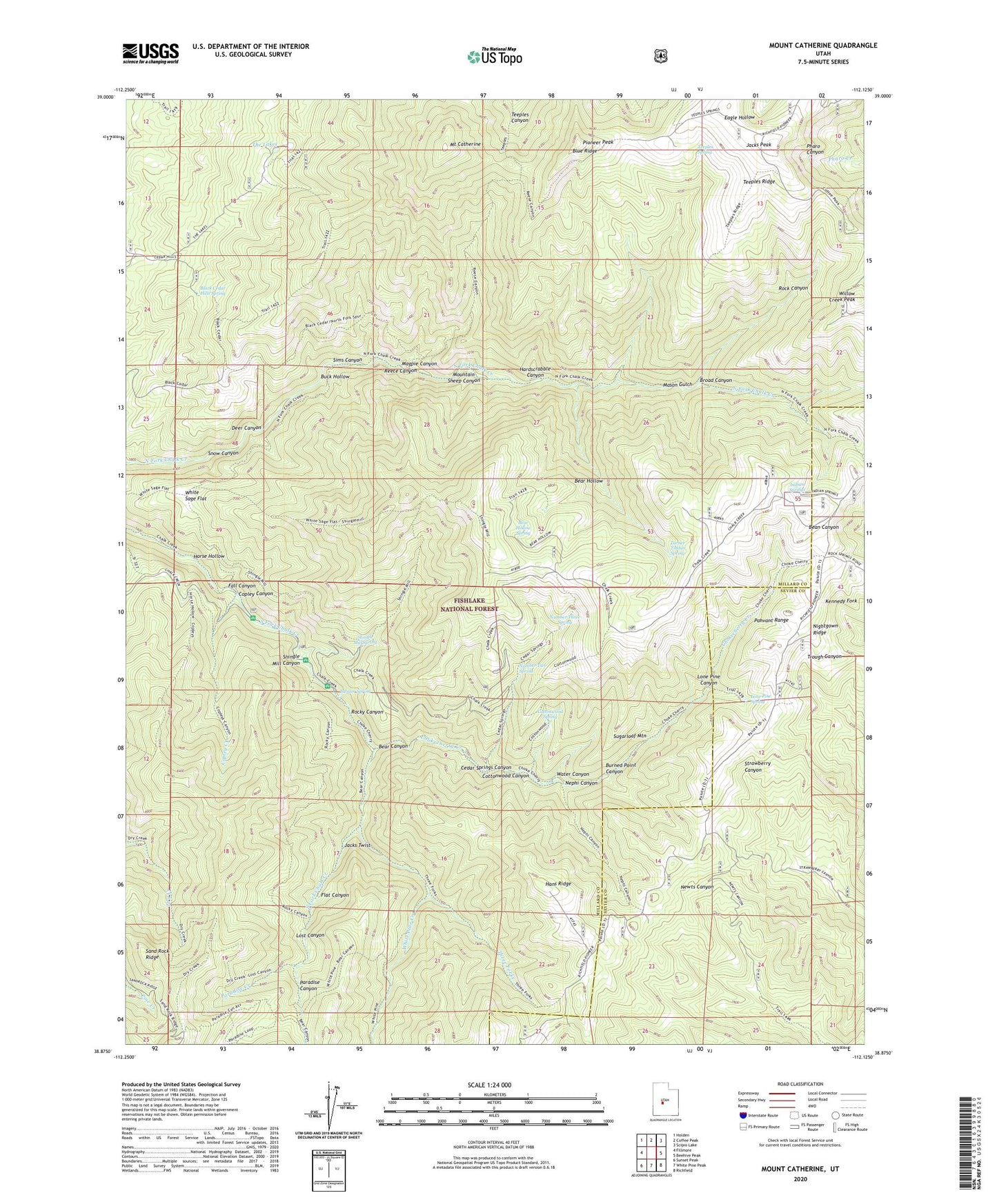
2020 topographic map quadrangle Mount Catherine in the state of Utah. Scale: 1:24000. Based on the newly updated USGS 7.5' US Topo map series, this map is in the following counties: Millard, Sevier. The map contains contour data, water features, and other items you are used to seeing on USGS maps, but also has updated roads and other features. This is the next generation of topographic maps. Printed on high-quality waterproof paper with UV fade-resistant inks.
Quads adjacent to this one:
West: Fillmore
Northwest: Holden
North: Coffee Peak
Northeast: Scipio Lake
East: Beehive Peak
Southeast: Richfield
South: White Pine Peak
Southwest: Sunset Peak
Contains the following named places: Balsam Picnic Area, Balsam Spring, Bear Canyon, Bear Hollow, Bear Hollow Spring, Black Cedar Hills Spring, Blue Ridge, Broad Canyon, Buck Hollow, Buckskin Charley Picnic Area, Burned Point Canyon, Cedar Springs Canyon, Chokecherry Creek, Copley Canyon, Copley Creek, Copleys Cove Picnic Area, Cottonwood Canyon, Cottonwood Spring, Deer Canyon, Fall Canyon, Flat Canyon, Hans Ridge, Hardscrabble Canyon, Horse Hollow, Indian Springs, Indian Springs Guard Station, Jacks Peak, Jacks Twist, Lone Pine Canyon, Lone Pine Spring, Lost Canyon, Magpie Canyon, Mason Gulch, Mount Catherine, Mountain Sheep Canyon, Nephi Canyon, Nightgown Ridge, Number Three Spring, Number Two Spring, Paradise Canyon, Paradise Creek, Pioneer Peak, Pistol Rock Picnic Area, Reece Canyon, Rock Canyon, Rocky Canyon, Sand Rock Ridge, Shingle Mill Canyon, Shingle Mill Picnic Area, Shingle Mill Spring, Sims Canyon, Snow Canyon, Solitude Guard Station, Sugarloaf Mountain, Teeples Ridge, Teeples Spring, Teeples Wash, The Lakes, Three Forks, Turner Timber Spring, Turner Wash, Water Canyon, White Pine Creek, White Sage Flat, Willow Creek Peak