MyTopo
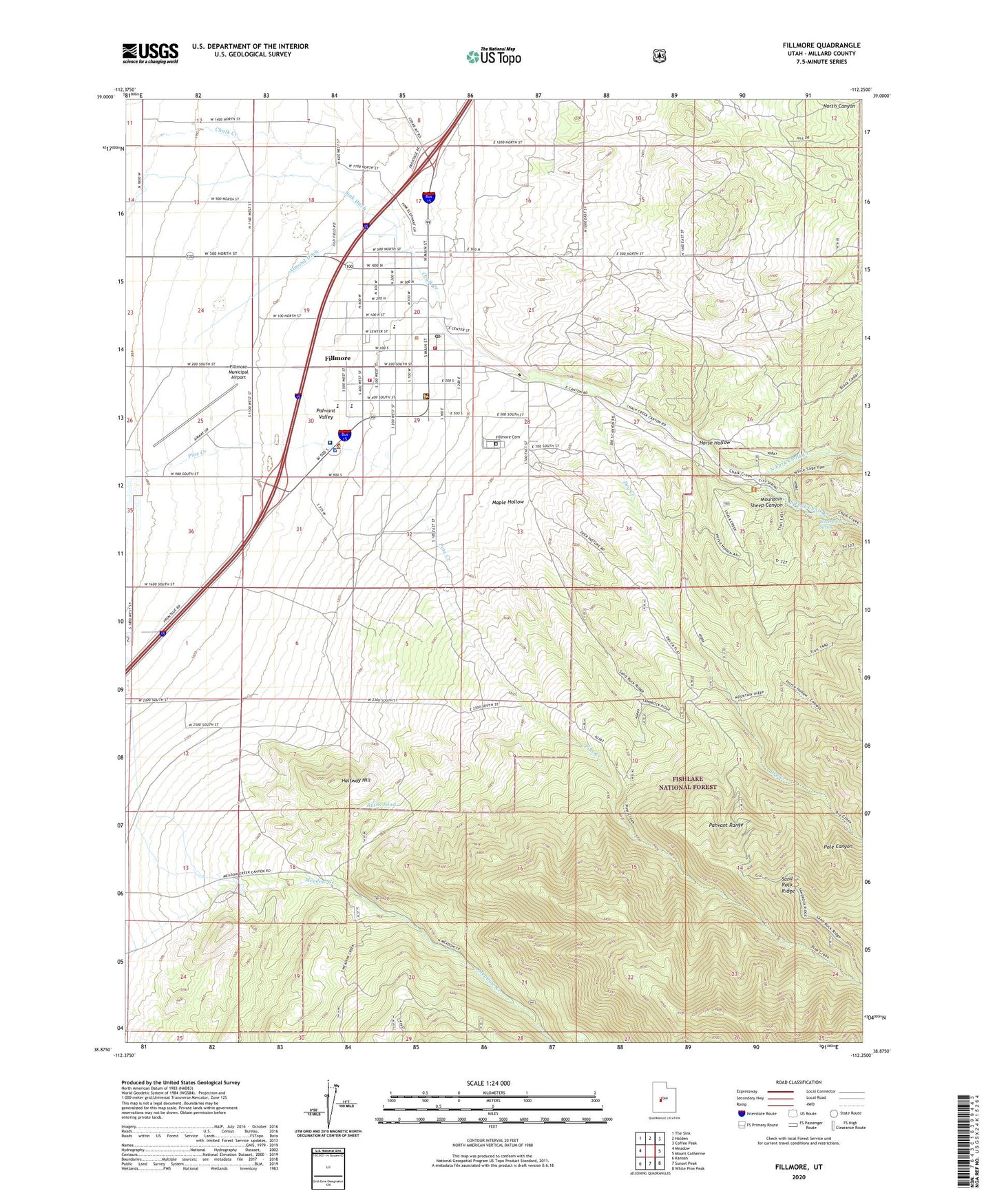
Fillmore Utah US Topo Map
Couldn't load pickup availability
Also explore the Fillmore Forest Service Topo of this same quad for updated USFS data
2023 topographic map quadrangle Fillmore in the state of Utah. Scale: 1:24000. Based on the newly updated USGS 7.5' US Topo map series, this map is in the following counties: Millard. The map contains contour data, water features, and other items you are used to seeing on USGS maps, but also has updated roads and other features. This is the next generation of topographic maps. Printed on high-quality waterproof paper with UV fade-resistant inks.
Quads adjacent to this one:
West: Meadow
Northwest: The Sink
North: Holden
Northeast: Coffee Peak
East: Mount Catherine
Southeast: White Pine Peak
South: Sunset Peak
Southwest: Kanosh
This map covers the same area as the classic USGS quad with code o38112h3.
Contains the following named places: Almond Ditch, Black Cedar Hill Wildlife Management Area, Cemetery Wildlife Management Area, City of Fillmore, Deer Pasture, Dry Creek, Fillmore, Fillmore Cemetery, Fillmore Community Medical Center, Fillmore Community Medical Center Heliport, Fillmore Elementary School, Fillmore Fire Department, Fillmore Middle School, Fillmore Municipal Airport, Fillmore Post Office, Halfway Hill, Halfway Hill Wildlife Management Area, Horse Hollow, Maple Hollow, Meadow Creek Campground, Millard County Ambulance Service Fillmore Station, Millard County Sheriff's Office, Millard High School, Mountain Sheep Canyon, North Fork Chalk Creek, Pole Canyon, Ruths Pond, Sink Ditch, South Fork Chalk Creek, Territorial Statehouse, The Church of Jesus Christ of Latter Day Saints, United States Forest Service Fiire Station Fillmore Ranger District, Utah Highway Patrol Section 14 Fillmore Office, Wagons West RV Campground, Watercrest Spring