MyTopo
Mount Dutton Utah US Topo Map
Couldn't load pickup availability
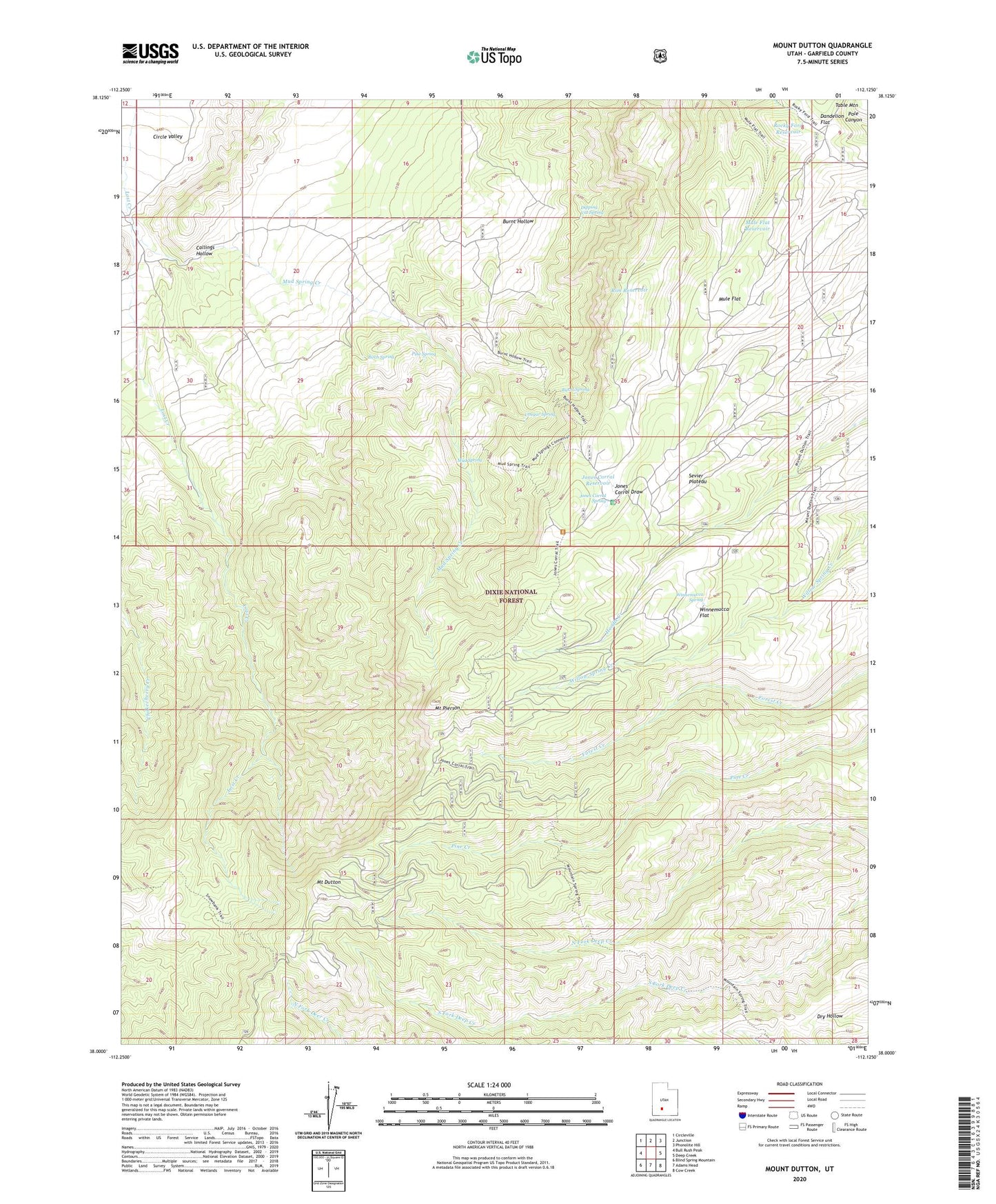
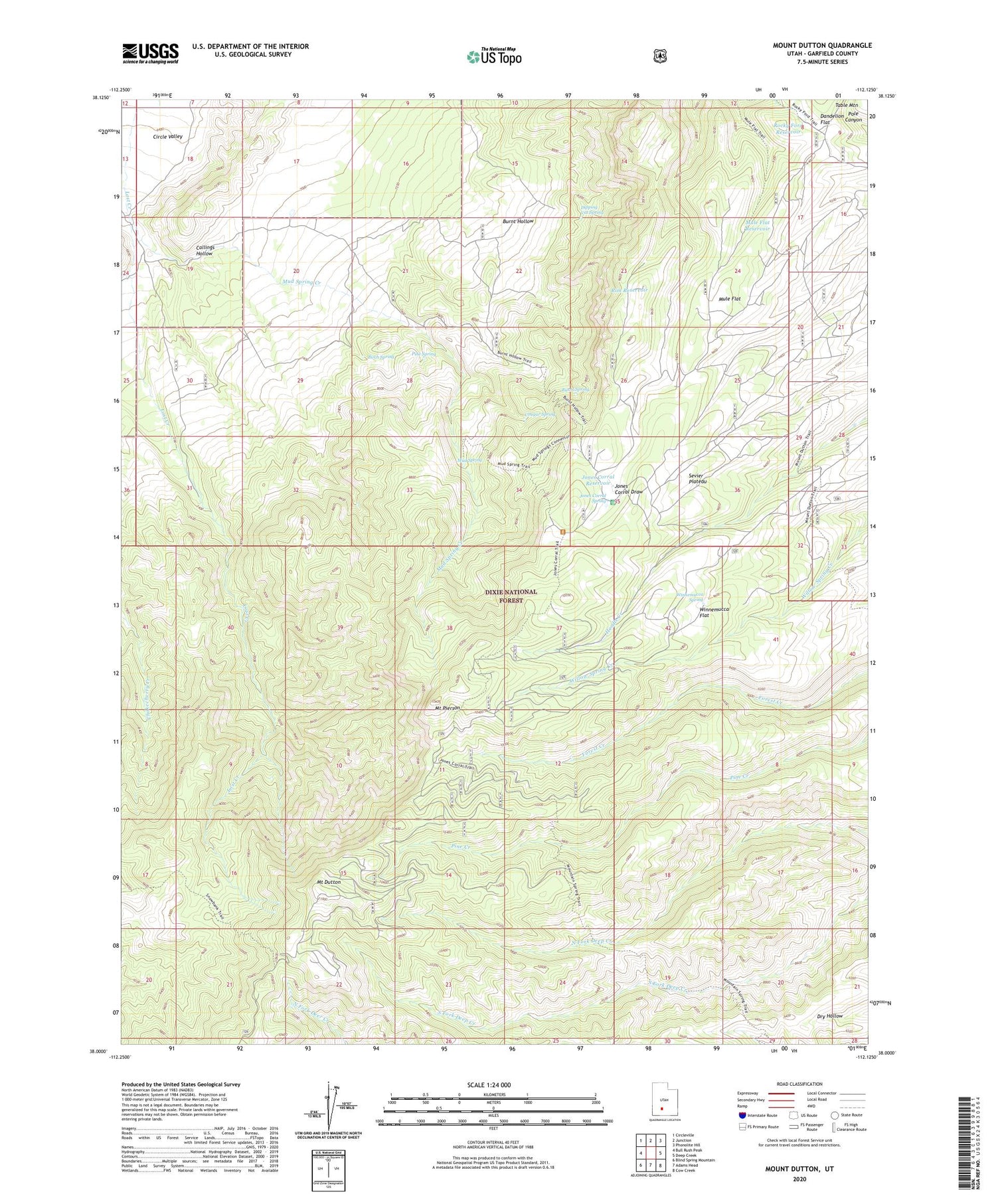
2020 topographic map quadrangle Mount Dutton in the state of Utah. Scale: 1:24000. Based on the newly updated USGS 7.5' US Topo map series, this map is in the following counties: Garfield. The map contains contour data, water features, and other items you are used to seeing on USGS maps, but also has updated roads and other features. This is the next generation of topographic maps. Printed on high-quality waterproof paper with UV fade-resistant inks.
Quads adjacent to this one:
West: Bull Rush Peak
Northwest: Circleville
North: Junction
Northeast: Phonolite Hill
East: Deep Creek
Southeast: Cow Creek
South: Adams Head
Southwest: Blind Spring Mountain
Contains the following named places: Birch Spring, Burnt Hollow Trail, Burnt Spring, Callings Hollow, Cougar Spring, Dandelion Flat, Dipping Vat Spring, Jones Corral Guard Station, Jones Corral Reservoir, Jones Corral Spring, Lost Creek, Mount Dutton, Mount Pierson, Mud Spring, Mud Spring Creek, Mule Flat, Mule Flat Reservoir, Pine Spring, Rim Reservoir, Rocky Ford Reservoir, Winnemucca Flat, Winnemucca Spring