MyTopo
Circleville Utah US Topo Map
Couldn't load pickup availability
Also explore the Circleville Forest Service Topo of this same quad for updated USFS data
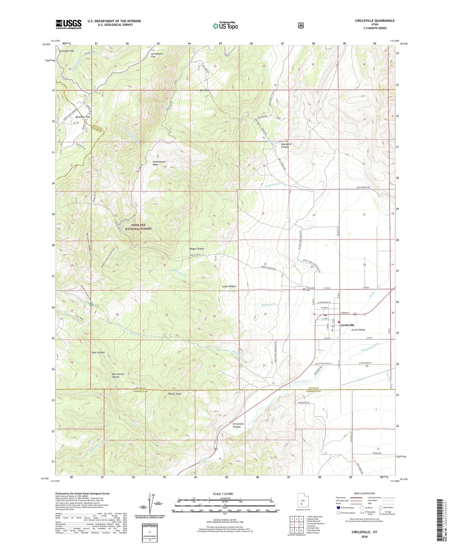
2023 topographic map quadrangle Circleville in the state of Utah. Scale: 1:24000. Based on the newly updated USGS 7.5' US Topo map series, this map is in the following counties: Piute, Garfield, Beaver. The map contains contour data, water features, and other items you are used to seeing on USGS maps, but also has updated roads and other features. This is the next generation of topographic maps. Printed on high-quality waterproof paper with UV fade-resistant inks.
Quads adjacent to this one:
West: Circleville Mountain
Northwest: Shelly Baldy Peak
North: Delano Peak
Northeast: Piute Reservoir
East: Junction
Southeast: Mount Dutton
South: Bull Rush Peak
Southwest: Fremont Pass
This map covers the same area as the classic USGS quad with code o38112b3.
Contains the following named places: Betenson Flat, Birch Creek, Bullberry Creek, Butch Cassidy Home, Chokecherry Creek, Circleville, Circleville Canyon, Circleville Cemetery, Circleville District Ranger Station, Circleville Elementary School, Circleville Fire Department, Circleville Post Office, Cottonwood Basin, Cottonwood Creek, Dock Spring, Kingston Canal, Little Pine Creek, Lost Creek, Lost Creek Canal, Lums Canyon, Oak Basin, Oak Basin Canyon, Parker Peak, Pine Creek, Piute County Ambulance Circleville, Pole Canyon, Pole Creek, Rile Norton Hollow, The Church of Jesus Christ of Latter Day Saints, Town of Circleville, Wades Canyon, ZIP Code: 84723