MyTopo
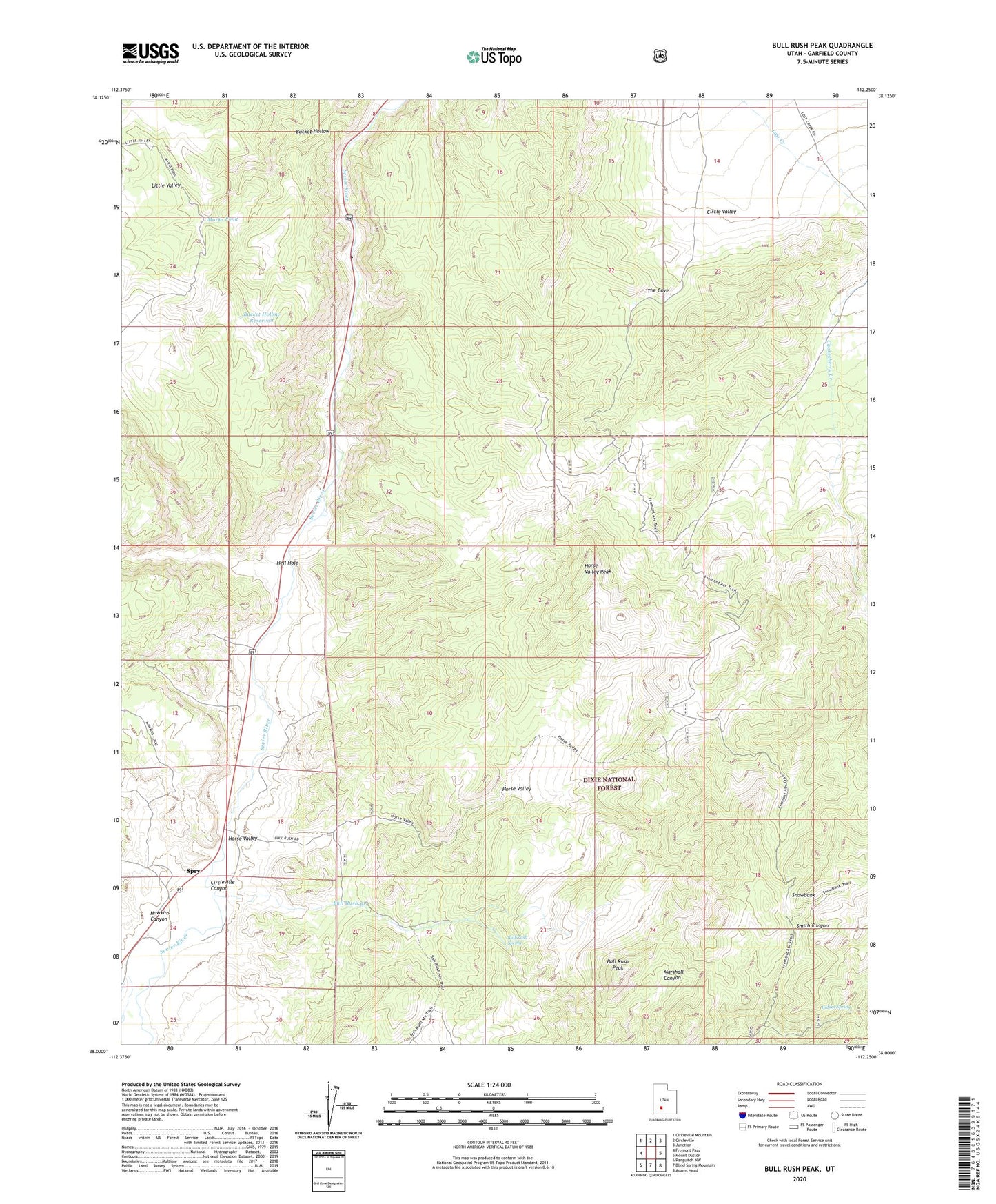
Bull Rush Peak Utah US Topo Map
Couldn't load pickup availability
Also explore the Bull Rush Peak Forest Service Topo of this same quad for updated USFS data
2023 topographic map quadrangle Bull Rush Peak in the state of Utah. Scale: 1:24000. Based on the newly updated USGS 7.5' US Topo map series, this map is in the following counties: Garfield. The map contains contour data, water features, and other items you are used to seeing on USGS maps, but also has updated roads and other features. This is the next generation of topographic maps. Printed on high-quality waterproof paper with UV fade-resistant inks.
Quads adjacent to this one:
West: Fremont Pass
Northwest: Circleville Mountain
North: Circleville
Northeast: Junction
East: Mount Dutton
Southeast: Adams Head
South: Blind Spring Mountain
Southwest: Panguitch NW
This map covers the same area as the classic USGS quad with code o38112a3.
Contains the following named places: Bucket Hollow, Bucket Hollow Reservoir, Bull Rush Creek, Bull Rush Peak, Bull Rush Spring, Chokecherry Creek, Hawkins Canyon, Hell Hole, Horse Valley, Horse Valley Peak, Indian Spring, Little Valley, Marks Pond, Snowbank, Spry, The Cove