MyTopo
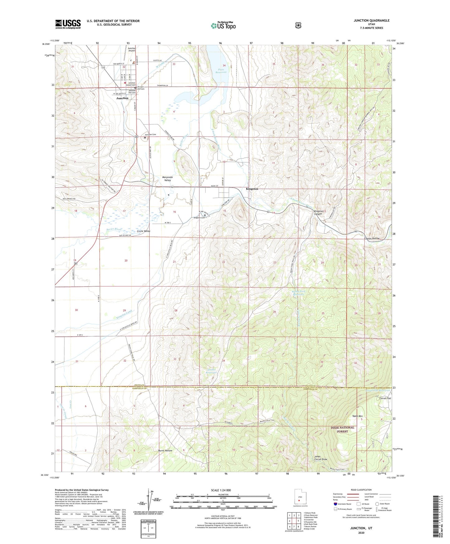
Junction Utah US Topo Map
Couldn't load pickup availability
Also explore the Junction Forest Service Topo of this same quad for updated USFS data
2023 topographic map quadrangle Junction in the state of Utah. Scale: 1:24000. Based on the newly updated USGS 7.5' US Topo map series, this map is in the following counties: Piute, Garfield. The map contains contour data, water features, and other items you are used to seeing on USGS maps, but also has updated roads and other features. This is the next generation of topographic maps. Printed on high-quality waterproof paper with UV fade-resistant inks.
Quads adjacent to this one:
West: Circleville
Northwest: Delano Peak
North: Piute Reservoir
Northeast: Malmsten Peak
East: Phonolite Hill
Southeast: Deep Creek
South: Mount Dutton
Southwest: Bull Rush Peak
This map covers the same area as the classic USGS quad with code o38112b2.
Contains the following named places: Burnt Hollow, Circle Valley, Coates Hollow, East Fork Sevier River, Jones Corral Draw, Junction, Junction Cemetery, Junction Fire Department, Junction Hill Cemetery, Junction Lower Cemetery, Junction Post Office, Kingston, Kingston Canyon, Kingston Cemetery, Piute County Ambulance, Piute County Sheriff's Office, Piute High School, Rocky Ford Creek, Rocky Ford Reservoir, Rocky Ford Trail, Smiths Reservoir, Table Mountain, Terrace Hill Cemetery, Town of Junction, Town of Kingston, West Canal, ZIP Code: 84743