MyTopo
Mount Pisgah Utah US Topo Map
Couldn't load pickup availability
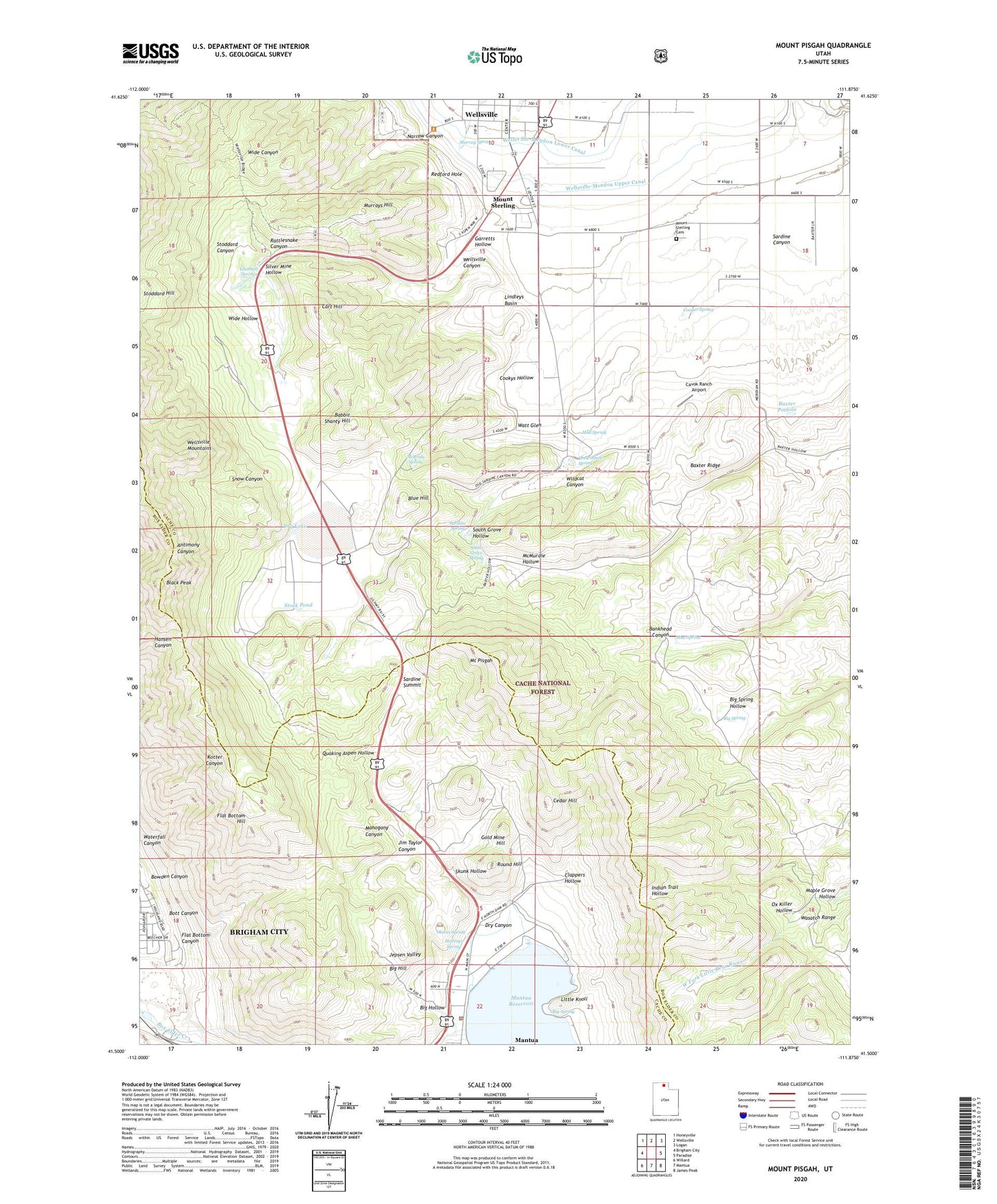
2020 topographic map quadrangle Mount Pisgah in the state of Utah. Scale: 1:24000. Based on the newly updated USGS 7.5' US Topo map series, this map is in the following counties: Cache, Box Elder. The map contains contour data, water features, and other items you are used to seeing on USGS maps, but also has updated roads and other features. This is the next generation of topographic maps. Printed on high-quality waterproof paper with UV fade-resistant inks.
Quads adjacent to this one:
West: Brigham City
Northwest: Honeyville
North: Wellsville
Northeast: Logan
East: Paradise
Southeast: James Peak
South: Mantua
Southwest: Willard
Contains the following named places: Babbit Shanty Hill, Bankhead Canyon, Bankhead Well, Baxter Pothole, Baxter Ridge, Big Hill, Big Hollow, Big Spring, Black Peak, Blue Hill, Bott Canyon, Bowden Canyon, Cart Hill, Cavok Ranch Airport, Cedar Hill, City of Wellsville, Clappers Hollow, Cookys Hollow, Cooper Spring, Dam Creek, Dry Canyon, Dry Lake, Flat Bottom Canyon, Flat Bottom Hill, Garretts Hollow, Gold Mine Hill, Hall Spring, Hallings Spring, Jepsen Valley, Jim Taylor Canyon, Leatham Springs, Lindleys Basin, Little Knoll, Mahogany Canyon, Mantua Police Department, Mantua Reservoir, Maple Grove Hollow, McBride Spring, Mount Pisgah, Mount Sterling, Mount Sterling Cemetery, Mud Spring, Murray Spring, Murrays Hill, Narrow Canyon, Olsens Spring, Ox Killer Hollow, Quaking Aspen Hollow, Rattlesnake Canyon, Redford Hole, Round Hill, Sardine Canyon, Sardine Spring, Sardine Summit, Silver Mine Hollow, Skunk Hollow, Snow Canyon, South Grove Hollow, South Grove Spring, Stock Pond, Stoddard Canyon, The Church of Jesus Christ of Latter Day Saints, The Pothole Spring, Town of Mantua, Waterfall Canyon, Watt Glen, Wellsville Canyon, Wellsville-Mendon Lower Canal, Wellsville-Mendon Upper Canal, Wide Hollow, Wildcat Canyon