MyTopo
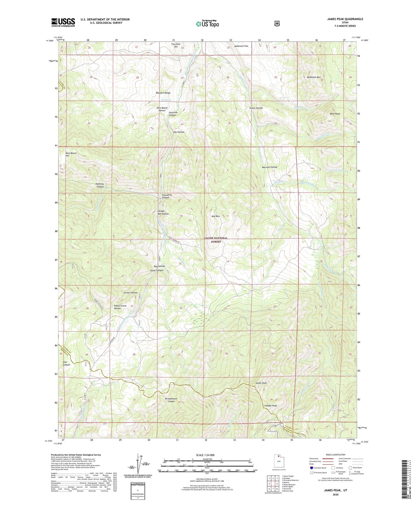
James Peak Utah US Topo Map
Couldn't load pickup availability
Also explore the James Peak Forest Service Topo of this same quad for updated USFS data
2023 topographic map quadrangle James Peak in the state of Utah. Scale: 1:24000. Based on the newly updated USGS 7.5' US Topo map series, this map is in the following counties: Cache, Weber, Box Elder. The map contains contour data, water features, and other items you are used to seeing on USGS maps, but also has updated roads and other features. This is the next generation of topographic maps. Printed on high-quality waterproof paper with UV fade-resistant inks.
Quads adjacent to this one:
West: Mantua
Northwest: Mount Pisgah
North: Paradise
Northeast: Porcupine Reservoir
East: Sharp Mountain
Southeast: Browns Hole
South: Huntsville
Southwest: North Ogden
This map covers the same area as the classic USGS quad with code o41111d7.
Contains the following named places: Alex Beard Hill, Alex Beard Hollow, Bald Head, Bald Head Creek, Birch Creek, Bluebell Mine, Cobabe Peak, Dips Hollow, Fish Creek, Fourmile Canyon, Fourmile Ranch, Halfway Canyon, Hidden Lake, Honey Bee Mine, James Peak, Jenson Hollow, McKenzie Flat, McKenzie Mountain, Middle Mountain, Mormon Hollow, Nip Hollow, North Fork Smith Creek, Pets Spring, Pole Creek, Powder Mountain Ski Area, Powder Mountain West, Public Grove Hollow, Shingle Mill Hollow, Smith Creek, South Fork Smith Creek, Starks Hollow, Threemile Canyon, Threemile Creek, Wellsville Creek