MyTopo
Mountain Dell Utah US Topo Map
Couldn't load pickup availability
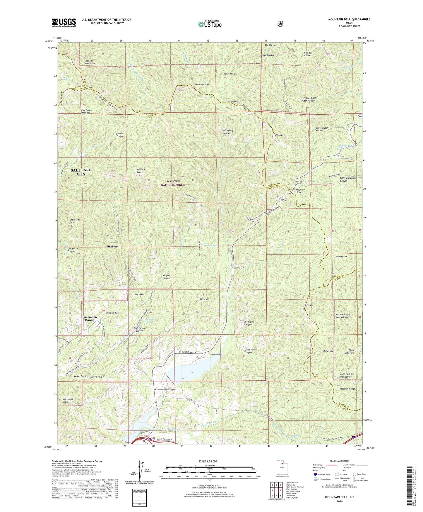
2020 topographic map quadrangle Mountain Dell in the state of Utah. Scale: 1:24000. Based on the newly updated USGS 7.5' US Topo map series, this map is in the following counties: Salt Lake, Morgan, Summit, Davis. The map contains contour data, water features, and other items you are used to seeing on USGS maps, but also has updated roads and other features. This is the next generation of topographic maps. Printed on high-quality waterproof paper with UV fade-resistant inks.
Quads adjacent to this one:
West: Fort Douglas
Northwest: Bountiful Peak
North: Porterville
Northeast: East Canyon Reservoir
East: Big Dutch Hollow
Southeast: Park City West
South: Mount Aire
Southwest: Sugar House
Contains the following named places: Alexander Creek, Alexander Spring, Bald Mountain, Big Hatch Canyon, Big Mountain, Big Mountain Pass, Birch Springs, Blue Bell Hollow, Boiler Hollow, Box Spring Hollow, Brigham Fork, Burr Fork, Camp Grant, City Creek Meadows, Clear Creek, Emigration Canyon Census Designated Place, Ephraim Hanks Station Pony Express Marker, Freeze Creek, George Washington Memorial Grove, Glory Hole, Glory Hole Fork, Henderson Spring, Kelvin Grove, Killyon Canyon, Killyons, Last Camp, Little Dell Reservoir, Little Hatch Canyon, Little Mountain, Little Mountain Summit, Lookout Peak, Maple City, Maple Grove, Margarethe, Metro Township of Emigration Canyon, Mountain Dell, Mountain Dell Canyon, Mountain Dell Dam, Mountain Dell Golf Course, Mountain Dell Park, Mountain Dell Reservoir, Mountain Top Park, Pinecrest, Swallow Rocks, The Narrows, The Sheep Trail, ZIP Code: 84108