MyTopo
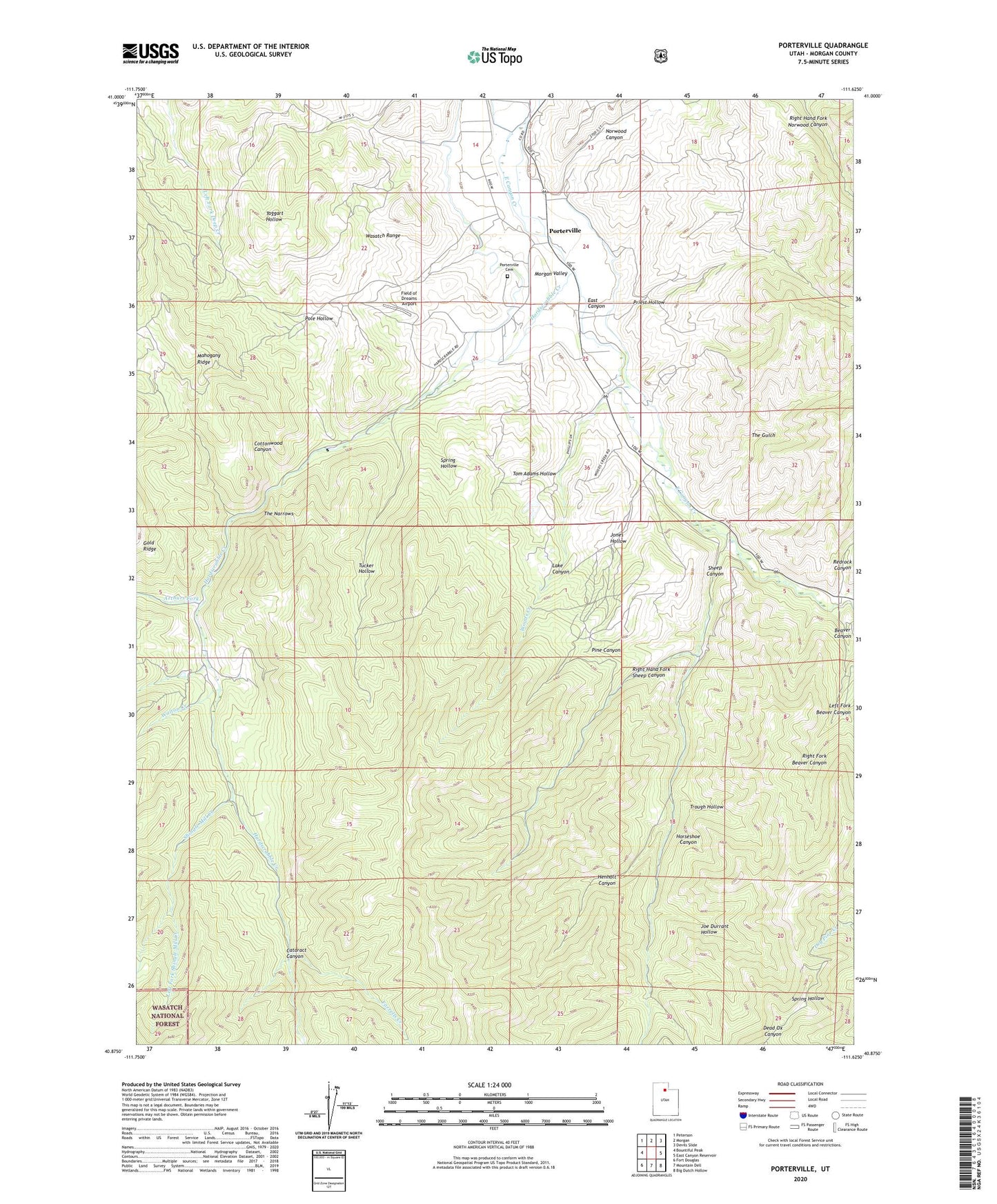
Porterville Utah US Topo Map
Couldn't load pickup availability
Also explore the Porterville Forest Service Topo of this same quad for updated USFS data
2023 topographic map quadrangle Porterville in the state of Utah. Scale: 1:24000. Based on the newly updated USGS 7.5' US Topo map series, this map is in the following counties: Morgan. The map contains contour data, water features, and other items you are used to seeing on USGS maps, but also has updated roads and other features. This is the next generation of topographic maps. Printed on high-quality waterproof paper with UV fade-resistant inks.
Quads adjacent to this one:
West: Bountiful Peak
Northwest: Peterson
North: Morgan
Northeast: Devils Slide
East: East Canyon Reservoir
Southeast: Big Dutch Hollow
South: Mountain Dell
Southwest: Fort Douglas
This map covers the same area as the classic USGS quad with code o40111h6.
Contains the following named places: Arthurs Fork, Beaver Canyon, Beaver Creek, Cataract Canyon, Cottonwood Canyon, East Canyon, Farrells Creek, Field of Dreams Airport, Hardscrabble Creek, Henholt Canyon, Horseshoe Canyon, Joe Durrant Hollow, Jones Hollow, Lake Canyon, Left Fork Beaver Canyon, Left Fork Shingle Mill Creek, Mahogany Ridge, Morgan South Division, Norwood Canyon, Pine Canyon, Pole Hollow, Porterville, Porterville Cemetery, Priest Hollow, Redrock Canyon, Richville Diversion Dam, Right Fork Beaver Canyon, Right Fork Shingle Mill Creek, Right Hand Fork Sheep Canyon, Sheep Canyon, Shingle Mill Creek, Spring Hollow, The Church of Jesus Christ of Latter Day Saints, The Gulch, The Narrows, Tom Adams Hollow, Trough Hollow, Tucker Hollow, Walton Creek, Whites Crossing, Woods Creek